Wednesday, 12 September 2012

September 11 in History - Churchill's Forgotten Speech

Churchill's "Every Man to His Post" speech:

On 5 September the Luftwaffe (Nazi Germany's air-force) switched tactics. Suddenly the weight of enemy attack was concentrated no longer against the bases of the Royal Air Force (of Britain), but against the civilian population of London and other major cities.

Churchill here gives full rein to his outrage and re-avows his determination to secure victory. And so, on 11 September, 1940, Winston delivered one of his iconic inspirational speeches though less famous compared to other speeches.

Saturday, 8 September 2012

A Brief Introduction to Medieval Scottish Culture

Right after Ireland, Scotland is probably my second-favourite European country (yes, I have an uncontrollable bias towards Gaelic nations, pity me). Though nowadays, there's much clamour about the upcoming "Vote For Independence" which could see Scotland seceding from the UK for the first time since the Treaty of Union in 1707. While I'm no political commentator (I'd be horrible at that, in fact), it would be simple ignorance to say Scotland couldn't survive on its own. For much of its history, Scotland was first a collection of petty kingdoms and then a unified kingdom under a succession of houses of royalty.. A unique Scottish culture emerged, rivaling that of their English neighbours to the south. In this post, we'll examine the unique culture of Scotland during the Medieval ages.
Languages:

Lingustics in 1400 (Blue-Gaelic,Yellow-Scots,Orange-Norse)
 Celtic languages were divided into distinct categories:
  • P-Celtic, which included Welsh, Breton, Cornish and Cumbric.
  • Q-Celtic, from which come the Goidelic languages: Irish, Manx and Gaelic
Over time, Gaelic became the chief language used by the Scots. It was typically an oral culture, especially in the Kingdom of Alba and much of the Highlands.

In the northern islands of the Shetlands and Orkneys, the norm language was Norse, which was introduced by Scandinavian occupiers who regularly raided and occupied the islands.

In the Scottish burghs (towns concentrated in the south and east of the country), English was the main language. This was due to the region being host to Anglian settlers who brought Old English with them. By 1124, French replaced Gaelic as the official language of the royal courts, evidenced by the presence of French documents.

Later, in the Scottish lowlands, Middle Scots (commonly known as English back then) became  became the dominant language of the country. It was derived largely from Old English, with the addition of elements from Gaelic and French. Although resembling the language spoken in northern England, it became a distinct dialect from the late fourteenth century onwards. It began to be adopted by the ruling elite as they gradually abandoned French. By the fifteenth century it was the language of government, with acts of parliament, council records and treasurer's accounts almost all using it from the reign of James I onwards. As a result, Gaelic, once dominant north of the Tay, began a steady decline

(For further reading)

Clothing:

There were strict rules, some enforced by Acts of Parliament, governing who could wear what in medieval and Renaissance times. Fashions changed across the centuries.
The clothes of a medieval bronze caster(from EducationScotland)

The general rule was that the poorer someone was, the simpler their clothes were: a simple belted tunic for peasants, shorter for men and longer for women, generally made of wool or linen.

Men wore ‘braies’ - large baggy underwear - beneath their tunics. Women wore long slips known as ‘kirtles’. Both men and women wore ‘hose’ - leggings like long stockings without feet.

In the early medieval period, women's clothing was patterned very much like men's, but with hems that always reached the ground. In the 11 and 12th centuries, women's clothing began to be more elaborate, with fitted waists and long, sweeping sleeves.

 Sometimes, the elaborate kirtle worn underneath was deliberately revealed by cutting holes in the outer garment or gathering it up at the waist.

In Scotland during the 12th century, most women would have dressed more simply than those in the court of the king of France. For everyday wear, dresses may have been made of plain, undyed wool cloth, worn over a linen kirtle.

 For more formal occasions, dresses made of red or yellow cloth would have added some colour. Belts made of wool or leather would also add some extra decoration

Nobles had access to any fabric they liked, including the exotic silks and velvets brought back by crusaders and merchants, but only royalty were permitted an ermine trim.

(For more information)

Education:

 The establishment of Christianity brought Latin to Scotland as a scholarly and written language. Monasteries served as major repositories of knowledge and education, often running schools and providing a small educated elite, who were essential to create and read documents in a largely illiterate society.
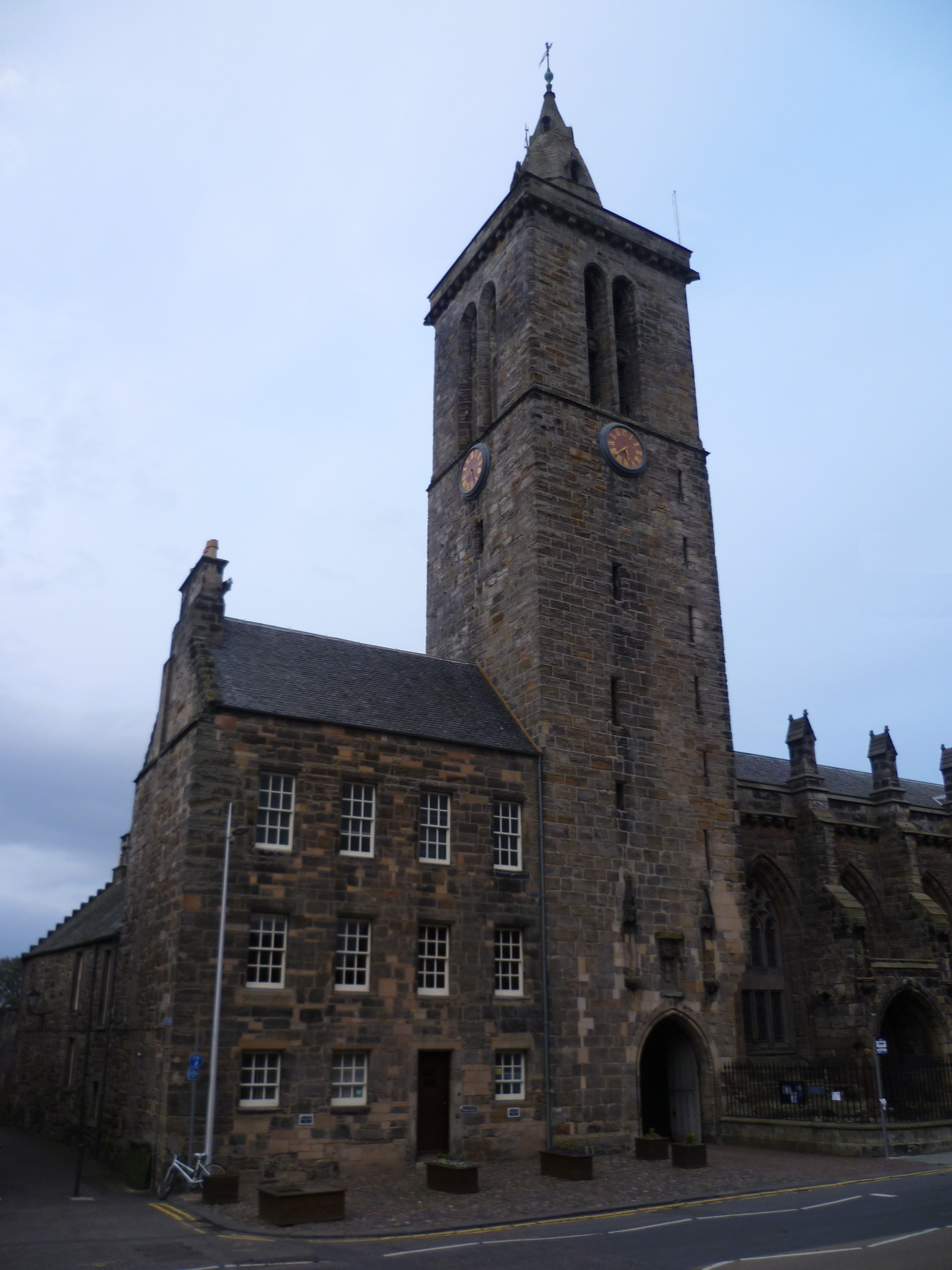
Tower of St. Salvator's College, St. Andrews.

 Until the fifteenth century, those who wished to attend university had to travel to England or the continent, and just over a 1,000 have been identified as doing so between the twelfth century and 1410. Among these the most important intellectual figure was John Duns Scotus, who studied at Oxford, Cambridge and Paris and probably died at Cologne in 1308, becoming a major influence on late Medieval religious thought. After the outbreak of the Wars of Independence, with occasional exceptions under safe conduct, English universities were closed to Scots and continental universities became more significant

This situation was changed by the establishment of the "ancient universities of Scotland". Four universities were established in the Middle Ages:
  • University of St Andrews – founded 1413 (incorporating the University of Dundee for most of its history until 1967) 
  • University of Glasgow – founded 1451   
  • University of Aberdeen – founded 1495 
  • University of Edinburgh – founded 1583
 (See A Companion to Medieval Scottish Poetry, pages 29 & 30)

Cuisine:

The accessibility of cuisine depended on location and class status. For example, a lord in a castle would have a small army to prepare the food for the household. The cook would lead the undercooks and the bakers. Larderers would make sure the kitchens were well stocked. Poulterers would prepare the birds. Bread was made fresh and baked in huge ovens. Fruit and vegetables were gathered from the castle’s orchards and gardens
And for ordinary people? Most ordinary Scots ate what we would eat today; They had two meals a day, made from food which they had grown or produced themselves. They ate a lot of food made with oats – a heavy kind of oat bread, porridge and rough, thick oatcakes called bannocks. Stews and thick soups called pottage were also common and sometimes mutton from sheep. Villagers close to the sea had easy access to fish. 
Haggis, arguably Scotland's national dish, has its origins from 1430
At different times of the year there would be different types of fruit and vegetables. Many people kept cows and hens for milk and eggs. Honey was the only way of sweetening food. Everyone - even children! - drank a weak kind of home-made beer made from barley because it was difficult to make sure that water was clean. 

Food was often strongly seasoned with herbs and spices, including garlic, rosemary, fennel, mint, parsley, cinnamon, peppercorns, root ginger, cloves and nutmeg. Some spices were imported via the Pilgrim routes to the Holy Land after they were brought back by crusaders. Salt was very expensive; such that it became a status symbol for kings and rich nobles. Some exotic medieval dishes included 'meat jelly'.

Medieval Scots also ate all sorts of creatures we don’t eat today including swans, peacocks, seals, lampreys and porpoises. They ate lots of birds including small wild birds as well as geese and pheasants. Fish was a regular dish as the church forbade the eating of meat during Lent and on Wednesdays, Fridays and Saturdays. Herring, pike, salmon and bream were commonly eaten as well as eels, which were caught in lochs with wicker eel traps and barbed eel spears.

Inspired by medieval food? Well, here's an old medieval cookbook. Have fun

Sunday, 2 September 2012

Vintage Maps of the Arabian Peninsula

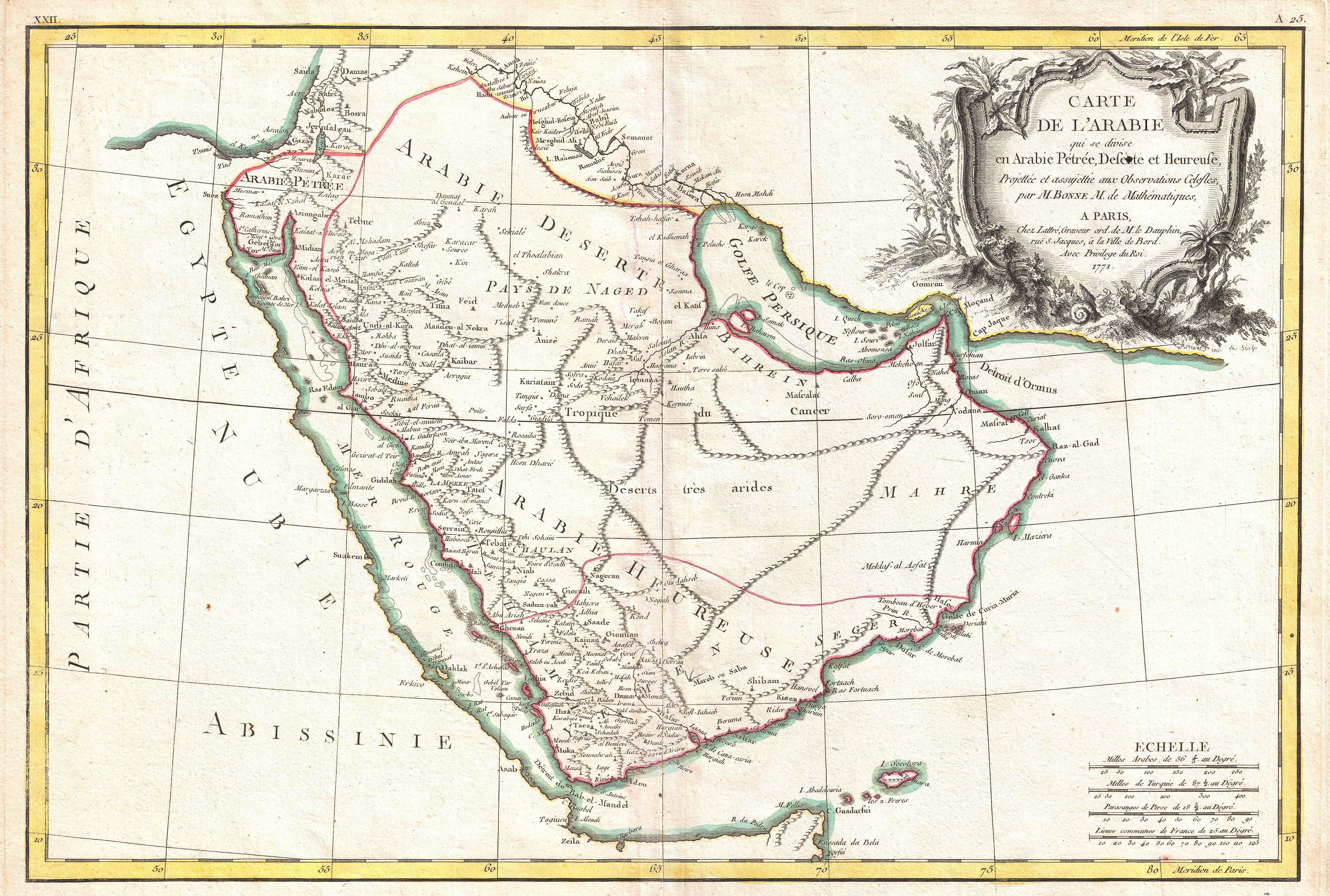
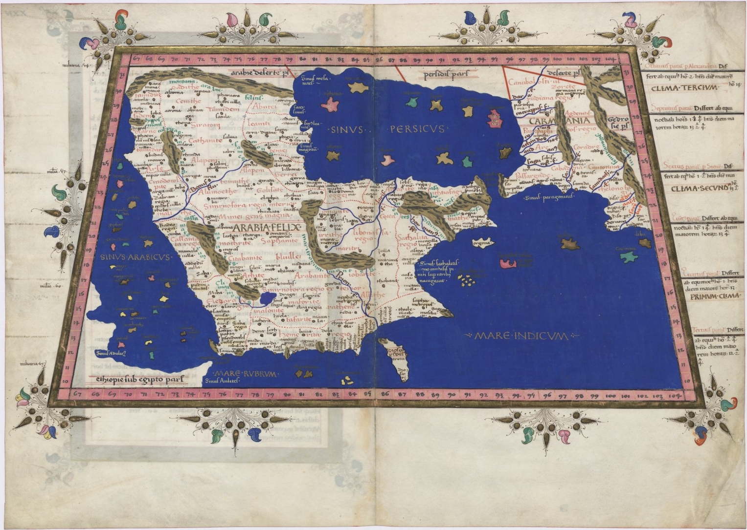
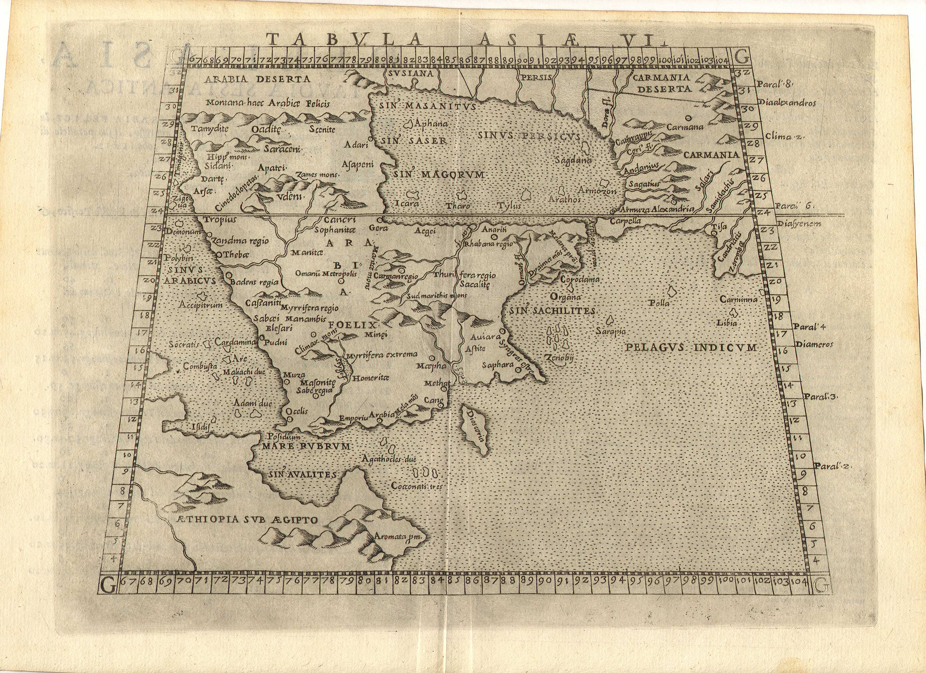
Some rather old maps of the Arabian peninsula, details under each respective map.

It's bigger when you click it !
Embedded text: This map of the Arabian Peninsula, published in 1720, shows Arabia Felix, Arabia Deserta, and Arabia Petraea. Other regions included are Palestine, Mesopotamia, Chaldea, Persia, Aegyptus, and Aethiopia. A large number of towns are shown. The title cartouche includes nine vignette coins. The tribal and town names on the map are those used by Ptolemy. Some are used more than once, with variations. Thus “Indicara,” “Iacara,” “Ichara,” and “Aphana” all could indicate the same place: the spot where Alexander the Great intended to build a capital on an island in the Arabian Gulf, enabling him to control the trade of the region and extend his empire (a scheme that he was unable to accomplish before he died).

 Archeological research suggests that this place was Failakah Island in present-day Kuwait, although some historians place it at Abu Ali Island. The map shows a peninsula near present-day Bahrain. The islands of “Arathos” and “Thylaso” indicate Muharraq and Bahrain islands, respectively, which are actually located north of Qatar. On this map, they are placed on the Persian coast side, probably because the cartographer confused them with “Hormuz” and “Qishm.” Qatar is mentioned on the map as “Catara,” but its shape and location are not accurate. The map is by Christoph Weigel, a German engraver, art dealer, and publisher.

Embedded text: This map from Ptolemy’s Geographia was published in 1578 and reprinted on many occasions between 1584 and 1704. It is much more finely engraved than maps in previous Ptolemy editions. The map mentions several places in present-day Qatar (Abucei, Leaniti, Themi, Asateni, and Aegei). Names added to this edition of the map include Mesmites Sinus, Idicar, and a second Idicar, located in present-day Kuwait. This name is similar to the island of “Ichara” found near Magorum Sinus. Contemporary research has confirmed that Kharj is the island known to the ancients as “Icara.” 
One of the major peninsulas shown on the map is named “Chersonesi Extrema,” near Catara. Modern scholarship has identified Chersonesos as Ras Rakn in present-day Qatar. Ichtyophagorium Sinus is the gulf inhabited by the people identified in ancient histories as the “Fish Eaters.” Claudius Ptolemaeus, known in English as Ptolemy, was an ancient mathematician, astronomer, geographer, and astrologer who was born sometime after 83 A.D., most likely in a town in the Thebaid called Ptolemais Hermiou in Roman Egypt. He lived in Egypt and died in Alexandria around the year 168.

Embedded text:  This 1616 map is a reprint of a map originally published in 1598 by Jodocus Hondius (1563-1612), a Flemish cartographer and engraver who settled in Amsterdam in about 1593 and established a business that produced globes and the first large maps of the world. The map covers the territory from west of the Gulf of Suez to the eastern side of the Arabian Peninsula, and from the mouth of the Euphrates River to Aden. The only cities indicated on the western coast of the Persian or Arabian Gulf are Qatar (“Catara”), “Godo,” and “Catiffa.”

 The map shows sandbanks around the coast and rivers at Medina and Mecca. Few towns and regions are shown, and there is a range of mountains in the center of the peninsula. Al Qatif is repeated as the town “Catiffa” and the region “Elcatif.” The peninsula opposite Bahrain Island, shown unnamed, is marked as where “Catara” is found. The commonly noted rivers of the Arabian coast are shown as very close together. The Arabian Gulf is called “Persicus Sinus” (Persian Gulf) and there is no name given for the Red Sea. The Ayaman area is shown as the most populated area on the map. The cartographer uses castles to denote cities and dotted lines to show the division of the Arabian Peninsula into three parts.
(Click for larger image)
 Embedded text: A beautiful example of Rigobert Bonne's 1771 decorative map of the Arabian Peninsula. Covers from the Mediterranean to the Indian Ocean and from the Red Sea to the Persian Gulf. Includes the modern day nations of Saudi Arabia, Israel, Jordan, Kuwait, Iraq, Yemen, Oman, the United Arab Emirates, and Bahrain. Names Mt. Sinai, Mecca and Jerusalem as well as countless other cities and desert oases. Also notes numerous offshore shoals, reefs, and other dangers in the Red Sea and the Persian Gulf. There is a large decorative title cartouche in the upper right hand quadrant. A fine map of the region. Drawn by R. Bonne in 1771 for issue as plate no. A 25 in Jean Lattre's 1776 issue of the Atlas Moderne .

Embedded text: A fine example of Rigobert Bonne and G. Raynal’s 1780 map of the Arabia and Abyssinia (Ethiopia). Covers from the Nile Delta south as far as the Horn of Africa and West to Persia, inclusive of the modern day countries of Ethiopia, Egypt, Saudi Arabia, Yemen, Oman, Kuwait, the and the United Arab Emirates. Offers surprising detail considering that his part of the world was largely unknown to Europeans.

 Identifies towns, rivers, some topographical features, ports and political boundaries. Dangerous reefs and other undersea dangers that historically hindered trade in the Red Sea and the Persian Gulf are tentatively ghosted in. Drawn by R. Bonne for G. Raynal’s Atlas de Toutes les Parties Connues du Globe Terrestre, Dressé pour l'Histoire Philosophique et Politique des Établissemens et du Commerce des Européens dans les Deux Indes .

(Click for larger image)
 Embedded text: A particularly interesting historic map, this is Karl von Spruner’s 1865 rendering of Arabia, Aethiopia (Ethiopia) and Egypt (Aegyptus) in antiquity. Centered on the Red Sea or Mare Rubrum , this map covers the entirety of the Arabian Peninsula, the Persian Gulf, and the Nile Valley as far south as Lake Tana (Pseuba), the source of the Blue Nile. Like most of Spruner’s work this map overlays ancient political geographies on relatively contemporary physical geographies, thus identifying the sites of forgotten towns and villages, the movements of armies, and the disposition of lands in the region. This particular example includes both ancient Latin and more contemporary Arabic names (transliterated of course) for many important regions and sites.

 Additionally, two inset maps are offered. In the lower left hand quadrant a map labeled “Heptanomis et Thebais” focuses on the course of the Nile from Heptatnomis (near Fayum) south to just past modern day Aswan, covering in the process many of the ancient Egyptian cities now submerged under the waters of Lake Nasser. Another inset, in the upper right quadrant, focuses on the fertile Nile Delta, forming an inverted triangle between Alexandria, Memphis, and Casluch. As a whole the map labels important cities, rivers, mountain ranges and other minor topographical detail. Territories and countries outlined in color. The whole is rendered in finely engraved detail exhibiting the fine craftsmanship for which the Perthes firm is known

(Click for larger image)
 The Arabian Peninsula by Nicolaus Germanus in 1467

Map of the location of Arab tribes in 600 AD
(Click for larger image)
  • Title:Arabia Felice Nuova Tavola
  • Made in Venice
  • FIRST EDITION 1561
  • SIZE 18.0 x 24.7 cms
  • TECHNIQUE Copper engraving
(Click for larger image)

Embedded text: Map of Persia and Arabia from J. H. Colton’s 1855 Atlas of the World. Covers Afghanistan, Iran, Iraq, Jordan, and the Arabian peninsula ( Saudi Arabia, Yemen, Kuwait, United Arab Emirates, and Oman). Map is a lithograph from a steel plate engraving. Details desert trading routes, oases, trading centers, etc. Beautiful hand color

Tuesday, 28 August 2012

History in Focus: The Iran-Iraq War

(Note: History in Focus is a new post style where I discuss a topic simply by posting photos [and if applicable, videos] of the event in question. I often found that this helps the reader to understand a topic much more thoroughly).

The Iran-Iraq war was a devastating eight-year war fought between the two countries between September 1980 and August 1988. The war started with a simultaneous air and land Iraqi offensive onto Iran which caught the Iranians off guard (with Iran still reeling from the chaos caused via their revolution).
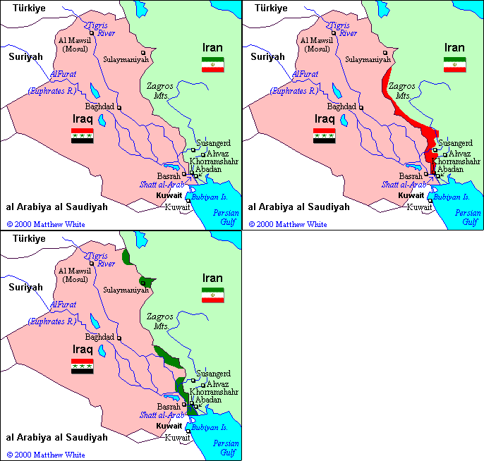
Iraqi gains (between 1980-82) and Iranian gains (1982-88)
The Iraqis made early gains, capturing the strategic border city of Khorramshar after a lengthy and bloody siege (The city was nicknamed "Khunistan" [City of Blood] by both sides during the conflict) and initiated the siege of Abadan. Much of the city of Abadan, including the oil refinery which was one of the world's largest refinery with capacity of 680,000 barrels per day, was badly damaged and almost destroyed by the siege.
Armed Iranian woman in Khorramshar during the siege
Oil wells on fire, outside Abadan, Iran.


Iraqi artillery battalion.
Iraqi soldiers posing after a victory

Trench warfare was common, as in WWI.
For much of 1981 and 1982, the Iraqi offensive halted in a stalemate. In 1982, Iraqi soldiers were repelled from Iranian territory and it seemed that the conflict would end with Iraq suing for peace. It did not, Iran was later on the offensive, dragging the war on for another six years.
Iraqi army and militia positions in the war (from HealingIraq.blogspot.com)
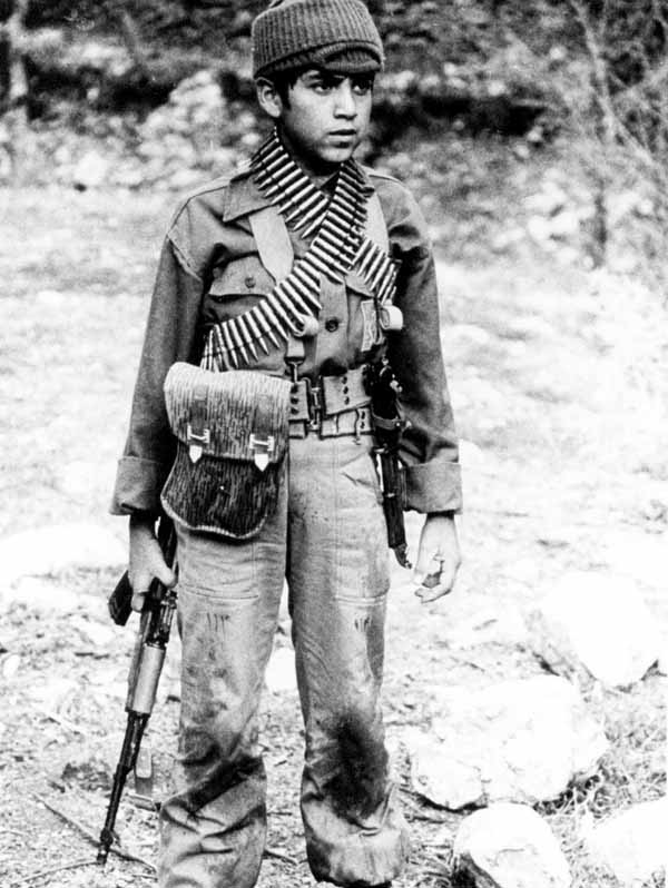
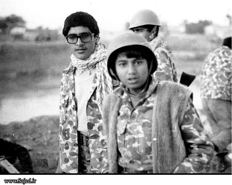
The war saw the mass recruitment of child soldiers
Child soldiers on the Iranian frontier

Sudanese volunteers marching. They joined the Iraqi Army in 1983.
Iraqi tank and soldiers cross beyond the Karun river
Iraqi soldiers in combat.
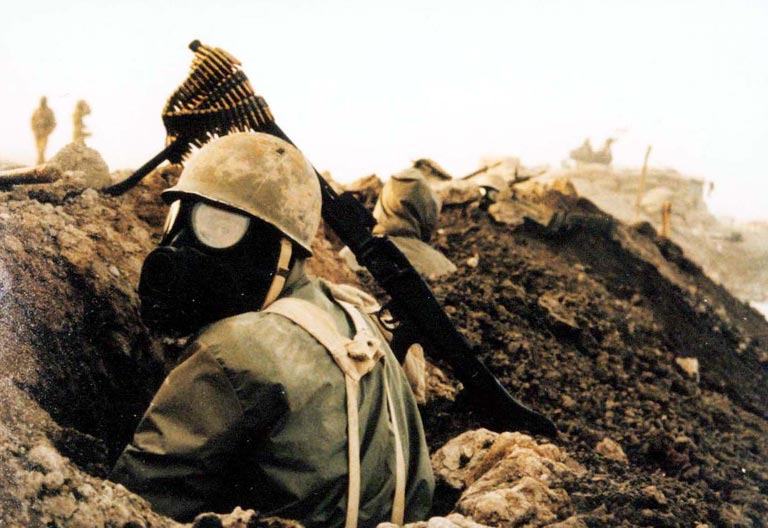
The Iranian offensive was slowed down and eventually halted by the deployment of chemical weapons, mainly mustard gas, by the Iraqi army. Iraq would later use these weapons for the remainder of the war, most notably in the gassing of the Kurdish village of Halabja.
Iranian soldier wears a gas mask and takes cover in a trench
Locations of the use of chemical weapons
Iranian soldiers equipped with gas masks. It helped them survive.
Victims of the gas attack at the Kurdish village of Halabja, Iraq. 5,000 died at least.
The war saw the constant bombardment, by both sides, of the other's cities and towns. Missiles and air raids were launched to bomb each other into submission. This was later dubbed as the "War of the Cities".
Kuwait was attacked by Iran in an airstrike over their support for Iraq
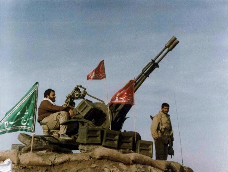
Iranian Revolutionary Guard mounting an Anti-Air gun in Iran
Iranian children lie dead after a school was bombed in 1987
Tanker Wars:

The conflict spilled into the Persian Gulf; both countries produced large amounts of oil and it was viewed that attacking and disabling oil installations in the combatant's country would damage their economy and eventually bankrupt them. However, this mini-war caused the US navy (a navy stronger than both Iran's and Iraq's combined) to escort Gulf oil tankers; there were still incidents. Iraq 'accidentally' bombed a US warship and Iran's practice of laying mines in the sea (which had damaged a US frigate) caused an American strike on the Iranian navy, taking out five Iranian naval vessels.
Oil tanker scuttled in the Shatt al Arab waterway on Saddam's orders to prevent sea access to southern Iraq
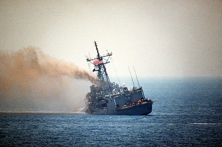
The USS Stark after being hit by an Iraqi fighter plane
Iranian boats like these littered the Gulf.
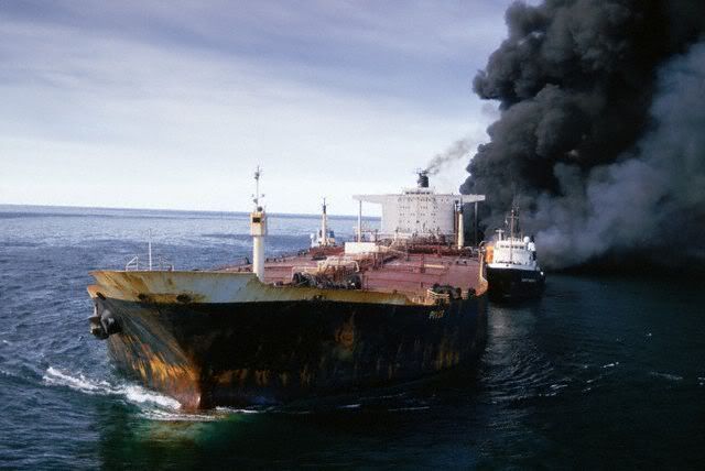
Oil tanker in flames after being hit by an Iranian missile.
After the USS Stark incident, American naval vessels were on high alert. In July 1988, the cruiser USS Vincennes shot down Iran Air Flight 655, killing all 290 passengers and crew on board. The American government claimed that the airliner had been mistaken for an Iranian F-14 Tomcat, and that the Vincennes was operating in international waters at the time and feared that it was under attack, which later appeared to be untrue.The Iranians, however, maintain that the Vincennes was in fact in Iranian territorial waters, and that the Iranian passenger jet was turning away and increasing altitude after take-off. U.S. Admiral William J. Crowe also admitted on Nightline that the Vincennes was inside Iranian territorial waters when it launched the missiles. The issue remains a controversial point in Iranian-American relations to this day.

Home Front:
As in WWI and WWII, the war brought in the massive pouring of military volunteers and aid to each country's armed forces.
Iranian children offer their spare savings to the war-front.
Military volunteers en route to the front-lines.
Most were never seen of again.
Iranian volunteers took up arms by the busloads (literally)
Iranian volunteers marching to the front-line.
Iranians from across the country joined the army
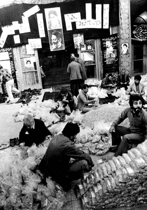
Civilians stock up supplies in a mosque along the frontline in Iran
Iran's first president, Banisadr, visiting an injured soldier.
Azadi sports stadium in Tehran was a focal recruitment area
International Reactions:

The UN deployed several observers to Iran to assess if chemical weapons were used and to report on how much were used.
UN weapons inspectors at work.

Taking photos of artillery shells
And of children... (???)
UN observers assess the level of chemicals used.
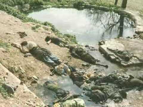
Casualties (graphic):

The war left a million dead, and hundreds of thousands injured.


Peace:

Peace was achieved in 1988. 100,000+ civilians killed on both sides, 320,000–720,000 Iraqi soldiers and militia killed and 150,000–375,000 Iranian soldiers and militia killed. Over a trillion dollars in damages occurred. This was the longest conventional war of the 20th century and one of the most brutal.

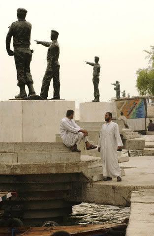
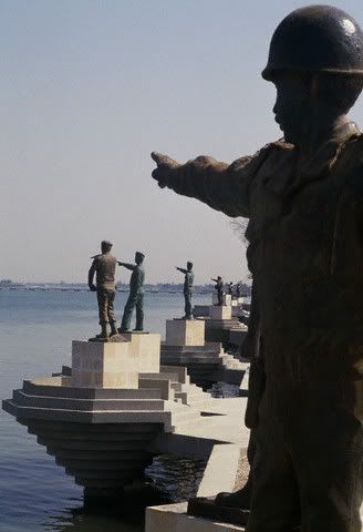
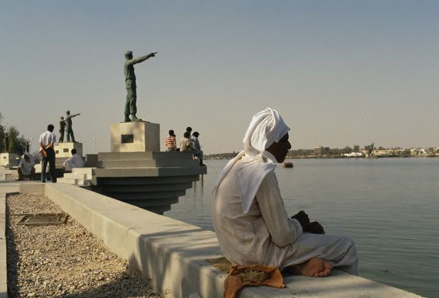
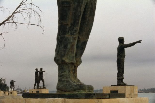
Iraq erected  101 statues with pointing fingers towards Iran, six miles away from the border, in memory of Iraqis killed during the Iran-Iraq War. The statues were destroyed by the British on March 31, 2003.


The Deforestation of Nabih Saleh in Bahrain - in Maps!

 This post is an example of the invaluable information and data provided by the groundbreaking people at mapBH . For those unaware, mapBH is...