Thursday 8 August 2013

Una Fatalia Storica - The Italian invasion of Libya


The Derna, a cargo ship, departed from Turkey in September 1911. Its cargo hold was filled with 20,000 rifles, 2 million rounds of ammunition and machineguns, destined to the Ottoman-Libyan port of Tripoli and to be distributed amongst loyal Libyan tribesmen. On 24 September, Italy caught wind of the ship’s journey and issued a warning to the Ottomans that “sending war materials to Tripoli was an obvious threat to the status quo” and endangered the Italian community in Libya. The ship started unloading its cargo at Tripoli harbor on the 26th of September. Infuriated, the Italian government issued a 24-hour ultimatum to the Ottoman empire on the 28th: the regions of Tripolitania and Cyrenaica are to fall under Italian jurisdiction and military occupation or else war would be declared. 

The Ottomans gave a reasonable and conciliatory reply but Italy would have none of it. On the 29th of September, Italy declared war on Ottoman Libya, a decision described by the Italian prime minister Giovanni Giolitti as fulfilling una fatalia storica – a history destiny.

The Ottoman-Italian war (photo from Commons)

Prelude
 
But why Libya? At the time, Libya (formally called the vilayat of Tripolitania) was a neglected region in the Ottoman empire. It had neither roads nor railways, and produced (in the terms of a contemporary European writer) “products of primitive husbandry” such as livestock and dates. The farming industry barely managed to produce food to feed the whole population. What reasons did the Italians have to be in Libya?

To answer this question, we must go back to the time when Italy was born without Rome nor Venice, in August 1863. The Opinione paper of Turin had warned that 
If Egypt and with it the Suez Canal falls to the British, and if Tunis falls to the French and if Austria expands into Albania, we will soon find ourselves without breathing space in the dead centre of the Mediterranean. “
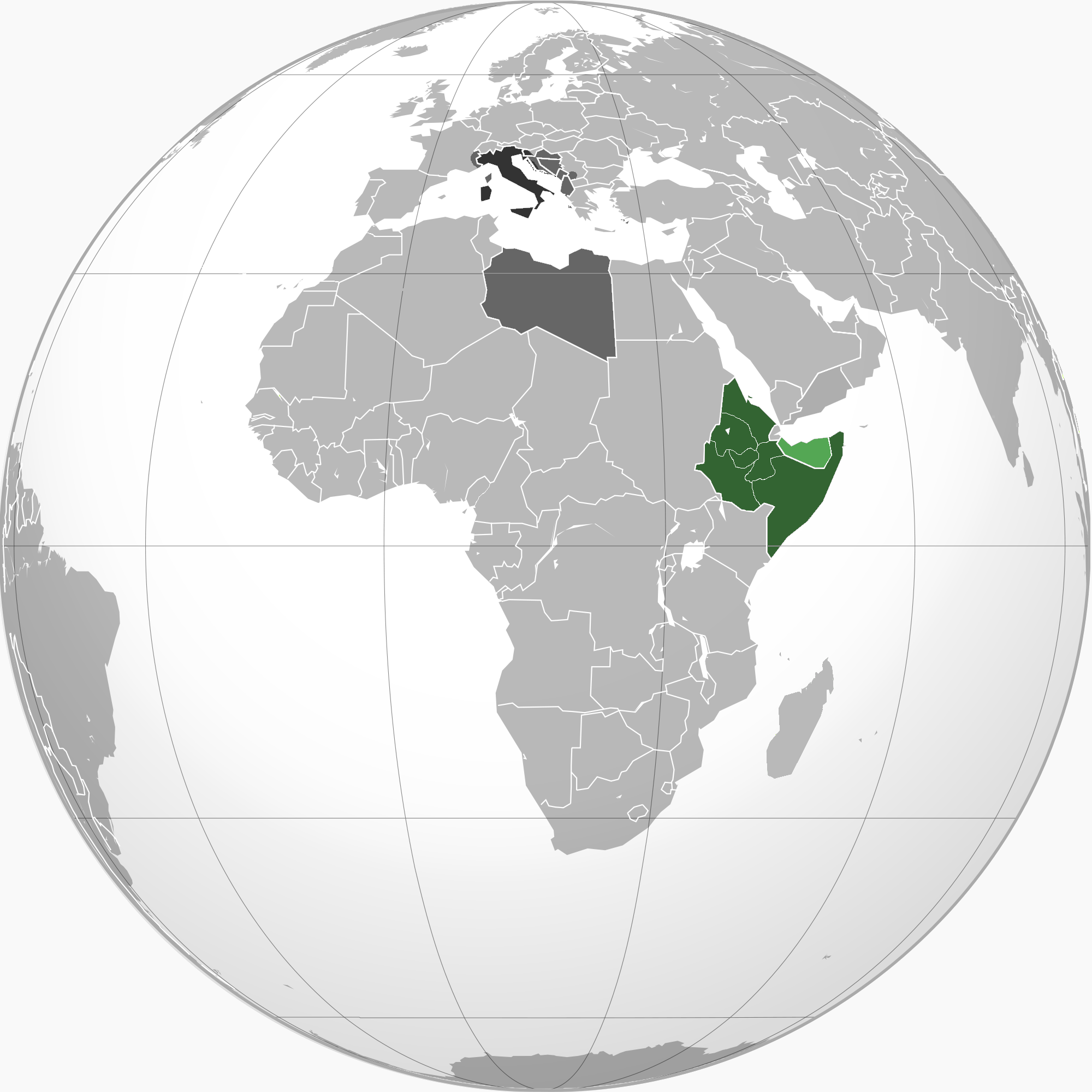
The Italian colonial empire, by 1940.
Even earlier, in 1838, Giuseppe Mazzini, who helped unify Italy, declared that North Africa belongs to Italy. In the 19th century, Italy was a relatively new & poor country that was seemingly surrounded by Great Powers on all three sides; the French, the Austrian Empire, the Ottomans and the British. Determined to become a Great Power in her own right, in the 1860s and 1870s, Italy began to court Tunisia, Rome’s first African colony and then still an Ottoman province. With a large Italian population of 25,000 by 1881, it seemed that Tunisia would be easy-picking for Italy. Unfortunately, the Bey (governor) of Tunisia accepted French rule in May 1881, dealing a blow to Italian pride and sending the country’s politicians panicking. 

France’s interference in Tunisia inadvertedly lead to Italy entering the Scramble For Africa, acquiring the unpromising but strategic regions of Somalia and Eritrea in 1889. Italy soon set its eyes on Ottoman Libya, compensation in their view for Tunisia. Control of Libya provided strategic access over the central Mediterranean, and territory close to the lucrative Suez Canal trade. In Italy’s view, they had to claim Libya to counter French (or others) influence in the Mediterranean. Mussolini later commented,
“For others, the Mediterranean is just a route. For us, it is life itself.”
From the 1880s until 1911, Italy pursued a vague policy of “peaceful penetration”; establishing Italian schools, encouraging the migration of Italian farmers in Cyrenaica (eastern Libya), setting up of Italian banks and funding mineral prospecting expeditions. The Italian public was largely supportive of the movement; as far back as 1889, Italian nationalists, industrialists and the Catholic Church had called for the colonial expansion, arguing that it would combat Italy’s alleged overpopulation and mass emigration to the United States. 
To emigrate is servile,' Italians were told, 'but to conquer colonies is a worthy task for a free and noble people”
Nationalist newspapers depicted Libya as a good source of grains and olives as well as possessing lucrative trade routes.  Italian explorers ventured to Libya, calling it Italy’s Fourth Shore, and described the potential wealth of the unexploited countryside and the seemingly endless green fields of Cyrenaica (in 1911, a writer went as far as to say that 1/4th of the country could be cultivated using irrigation).

But why not simply invade? Why go through this decades-long process? The reason was that the Italians feared an invasion of Ottoman Libya would result in a greater European war, with perhaps the Austrians making unacceptable gains in the Balkans, and potential backlash with France or other European powers. As a result, the Italian diplomatic goal was to secure assurances and guarantees from Europe’s powers. In the 1900s, Italy acquired assurances from Britain, Austria & Germany (both being Allies), Russia and the United States. Year after year, the Italians waited for their opportunity to strike. In 1911, in the aftermath of the Agadiz crisis that saw France gain even more territory in North Africa, Italy decided to act, scheduling an invasion in the autumn, when the sea was calmest. 

Italy needed a casus belli and it found one. In 1908, two Italians (one of them a priest) were murdered in Tripoli, and the Ottoman investigation proved inconclusive. The Italian media hunched onto the story, claiming that Italian lives and property were in danger in Libya and campaigned furiously for an occupation. With the backing of the majority of the public (minus the Socialists, who rioted against the idea of an “imperialist invasion”, interestingly enough Mussolini was amongst the rioters and was jailed for his criticism of the invasion) and the Catholic Church (who praised the “crusading spirits” of the masses) , the invasion seemed in place. 

War & Peace:

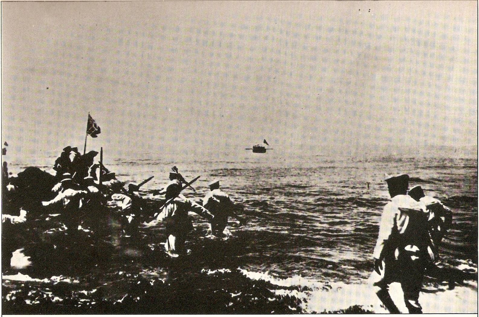
Italian landing at Tripoli, October 1911
After the Derna incident, four Italian battleships disembarked from Italy on the 1st of October and anchored the next day outside of Tripoli. It was only at 3:15pm on the 3rd of October that the ships began bombarding the three Ottoman forts of Tripoli. On the 5th , 900 marines landed and captured the badly-damaged forts. The Turkish commander and his depleted garrison, seeking to spare the city from bombardment, withdrew from the city. By nightfall, around 1,700 more marines occupied the town of Tripoli. The Ottoman garrison, numbering less than 5,000, regrouped with Libyan tribesmen inland whilst the Italian vanguard awaited the arrival of the main expeditionary force, which arrived a week later.  
 
The Italian fleet, off the coast of Tobruk, in October 1911
Italy had hoped the Turks would seek negotiations after the capture of Tripoli but they had no intention to. The Italians were surprised to face stiff resistance from the native Libyans whom they thought would welcome them as liberators. East of Tripoli, the Italians were almost overwhelmed by a combined Libyan-Turkish assault at Henni on the 23rd of October. Meanwhile in Cyrenaica, Italian amphibious landings and shelling resulted in the capture of Tobruk, Derna and Homs on the 4th, 18th and 21st of October.

 On 18 October, another Italian battle fleet (consisting of 7 battle cruisers and 20 transport ships) anchored outside Benghazi and issued a 24-hour ultimatum, demanding the town’s surrender. The 280-man garrison defended the town against hopeless odds. After the ultimatum expired, the fleet shelled the city to the ground, destroying the city’s Grand Mosque and damaging the Franciscan mission as well as the British and Italian consulates, all of which were packed with refugees. Later that day, the Turkish garrison surrendered, but the Italian occupiers faced unexpected resistance from the inhabitants of the suburbs. The Turko-Libyan forces withdrew from the town in the next few days.
Italian battery bombardment of Benghazi

By the end of October 1911, Italy controlled five beachheads on the Libyan coast and had deployed 34,000 men, 6,300 horses,  1,050 wagons, 145 warships amongst others. The war was the first to see the deployment of new technologies such as machineguns, radio-telegraph and motor-transport as well as aeroplanes in battle. 

The town of Tripoli rioted against the Italians at the end of October but was brutally suppressed. On 5 November 1911, the Italian King Victor Emmanuel issued a royal decree, bringing Tripolitania and Cyrenaica under the Italian Crown. In what is comparable to George Bush’s premature “Mission Accomplished” declaration in 2003, so too was King Victor’s. It would take twenty years before Libyan resistance was effectively subdued. 

The invasion was a disaster primarily because it failed to account for the actions of the native Libyan population. The Italians had hoped the Libyans would welcome them as saviours from the corrupt Turks or at the very least to stay neutral in the war. However, the Italians failed to recognize that the Libyans and the Ottomans were bound in religion. Both people were Muslim and to the Libyans, they were fighting against an invading Christian army akin to the Crusaders. This blunder lead to the war being dragged out for a year, much to the relief of the Turks who were also surprised by the support they were given.

 Due to Italian naval supremacy and Britain’s reluctance to allow Ottoman troops to march through Egypt, reinforcements could not be directly sent. However, colonels and generals (such as a young Mustafa Kemal) smuggled their way through Egypt into Libya. Arms were smuggled from Greece and French Tunisia also.  The influential Sanussi tribesmen of Cyrenaica’s desert rallied armies in support of the Ottomans, though with poorly armed weaponry. 

A young Mustafa Kamel, in Derna (1912)
In 1912, a stalemate was reached. The Italians in Tripoli had managed to extend their radius of control by a few miles, the port of Misrata was captured in February. Italian troops were deployed to the Tunisian frontier to cease the arms smuggling. After 11 months, none of the five beach-heads had linked up. The Italian army dugged in in Derna were besieged by a 10,000-man irregular army.  
 
The signing of the treaty of Lausanne
The war was demoralizing for Italy (who expected it to be a walk-in-the-park) but worse for the Turks, who faced unrest in the Balkans and other regions.

 In July 1912, the Turks and Italians quietly met in Lausanne on the shores of Lake Geneva. It was only on 17 October 1912 that both parties declared peace, much to the surprise of Libyans who felt betrayed.  The treaty they signed was vague; the Ottoman Sultan was to declare Tripolitania and Cyrenaica as independent and that Libyans were now Italian subjects. In return, the Italians withdrew from the Dodecanese islands in the Aegean Sea. The Sultan also retained the power to appoint the grand religious cleric of Tripoli, allowing the Ottomans to retain religious control over the region. 

For the Italians, it was a cheap and fairly easy victory. The Ottomans could not afford to continue the war. However, Libyan irregulars continued to fight on. With the Italians only in control of the coastal settlements, Libya’s interior remained hostile tribal territory. To the Ottomans, their fight ended. To the Libyans, their fight has just begun.

References:
Writer's note: This post was originally written for itshistorypodcasts.com and published on 6 August 2013 (viewable here).

Friday 2 August 2013

Freshen Up With Archaeology Friday (Post X)

Coffin within a coffin found near Richard III site

Archaeologists have unearthed a mysterious coffin-within-a-coffin near the final resting place of Richard III

The coffin-in-a-coffin. (Photo from the University of Leicester)
The University of Leicester team lifted the lid of a medieval stone coffin this week -- the final week of their second dig at the Grey Friars site, where the medieval king was discovered in September.
This is the first fully intact stone coffin to be discovered in Leicester in controlled excavations -- and is believed to contain one of the friary's founders or a medieval monk.

Within the stone coffin, they found an inner lead coffin -- and will need to carry out further analysis before they can open the second box.

Archaeologists have taken the inner lead coffin to the University's School of Archaeology and Ancient History, and will carry out tests to find the safest way of opening it without damaging the remains within.

It took eight people to carefully remove the stone lid from the outer coffin -- which is 2.12 metres long, 0.6 metres wide at the "head" end, 0.3 metres wide at the "foot" end and 0.3 metres deep.
The inner coffin is likely to contain a high-status burial -- though we don't currently know who it contains.

Full article

Oldest European fort in inland America discovered in the Appalachian mountains:
The uncovered fort (Photo from the University of Michigan)
The remains of the earliest European fort in the interior of what is now the United States have been discovered by a team of archaeologists, providing new insight into the start of the U.S. colonial era and the all-too-human reasons spoiling Spanish dreams of gold and glory. 

Spanish Captain Juan Pardo and his men built Fort San Juan in the foothills of the Appalachian Mountains in 1567, nearly 20 years before Sir Walter Raleigh's "lost colony" at Roanoke and 40 years before the Jamestown settlement established England's presence in the region. 
"Fort San Juan and six others that together stretched from coastal South Carolina into eastern Tennessee were occupied for less than 18 months before the Native Americans destroyed them, killing all but one of the Spanish soldiers who manned the garrisons," said University of Michigan archaeologist Robin Beck.  Beck, an assistant professor in the U-M Department of Anthropology and assistant curator at the U-M Museum of Anthropology, is working with archaeologists Christopher Rodning of Tulane University and David Moore of Warren Wilson College to excavate the site near the city of Morganton in western North Carolina, nearly 300 miles from the Atlantic Coast. 

 The Berry site, named in honor of the stewardship of landowners James and the late Pat Berry, is located along a tributary of the Catawba River and was the location of the Native American town of Joara, part of the mound-building Mississippian culture that flourished in the southeastern U.S. between 800 and about 1500 CE.

In 2004, with support from the National Geographic Society and the National Science Foundation, Beck and his colleagues began excavating several of the houses occupied by Spanish soldiers at Joara, where Pardo built Fort San Juan. Pardo named this small colony of Spanish houses Cuenca, after his own hometown in Spain. Yet the remains of the fort itself eluded discovery until last month. 
"We have known for more than a decade where the Spanish soldiers were living," Rodning said. "This summer we were trying to learn more about the Mississippian mound at Berry, one that was built by the people of Joara, and instead we discovered part of the fort. For all of us, it was an incredible moment."  
Using a combination of large-scale excavations and geophysical techniques like magnetometry, which provides x-ray-like images of what lies below the surface, the archaeologists have now been able to identify sections of the fort's defensive moat or ditch, a likely corner bastion and a graveled surface that formed an entryway to the garrison.

Excavations in the moat conducted in late June reveal it to have been a large V-shaped feature measuring 5.5 feet deep and 15 feet across. Spanish artifacts recovered this summer include iron nails and tacks, Spanish majolica pottery, and an iron clothing hook of the sort used for fastening doublets and attaching sword scabbards to belts. 

Fort San Juan was the first and largest of the garrisons that Pardo founded as part of an ambitious effort to colonize the American South. Pedro Menéndez de Avilés, who had established the Spanish colonies of St. Augustine and Santa Elena in 1565 and 1566, respectively, spearheaded this effort. Of the six garrisons that Pardo built, Fort San Juan is the only one to have been discovered by archaeologists.


Today's featured reading:

Friday 19 July 2013

Rome's Forgotten Expedition: Arabia Felix

The Roman Empire, at its peak
The Romans were arguably history's greatest war machine. Conquering the Italian peninsula from the Latin League whilst being politically and militarily outnumbered, subduing the relentless Gauls of modern-day France, wiping out the Carthaginian civilisation and bringing an end to the Seleucid Empire. The year is 25 BC, Rome's empire stretches from the Iberian peninsula to Egypt. But this was during the time of Octavian, founder of the Roman empire and he wanted to expand his newly-created empire. It should be no surprise that he referred to himself as Imperator Caesar Divi Filius Augustus, Imperator meaning 'Emperor' which is where the term originates from. Seeking to expand his empire, Augustus set his sights on Arabia Felix, in modern-day Yemen.
 
Arabia Felix, on a map by Ptolemy.

Of all places, why Arabia Felix? Why conquer a land in a seemingly hot desert region at the world's end? To understand, it is necessary to look at the situation from the Roman perspective. The Latin phrase 'Arabia Felix' literally translates into 'Happy Arabia' but is meant to imply 'Blessed Arabia' (Romans and their Latin, eh?). Many geographers and historians in antiquity referred to Arabia Felix as being extremely wealthy, owing to its strategic position in the incense trade. 

The legendary riches of the Nabataeans (those who lived beyond south of the Roman province of Syria) and Sabaeans (the inhabitants of Yemen) had captured Roman imaginations for centuries. Gold, silver, perfume, incense; control over these goods would provide a solid supply of income for the Roman coffers. The illusion of legendary Nabataean riches caught the attention of the likes of Antigonus the One Eyed of Macedon, the Roman general Pompey amongst others.

Augustus had other reasons for choosing Arabia Felix over the other regions in the Middle East. Persia's riches were guarded by the Parthian empire whereas mainland Arabia had no empire to guard its riches. Augustus brushed aside the minor Arabian kingdoms in the south and ordered Aeilius Gallus, the governor of Roman Egypt, to lead an expedition along the Red Sea coast of Arabia (and Ethiopia) with the purpose of conquests. The Nabataeans encouraged the Romans, promising to cooperate and provide assistance against the Sabaeans, their motives hidden.
The incense trade route (From Ancient Cultures.net)

The expedition was doomed to fail before it even began. Poor leadership, poor planning and a poor choice of guides were to blame. The expedition landed on the Arabian side of the Red Sea, with one source stating they landed near Aynunah on the north side. Other sources state they landed in the Nabataean port of Leuce-Come. The sea journey was disastrous; the vast majority of the boats and crew were lost to rocky shores, improper storage of provisions and scurvy. The expedition's strength was depleted to the extent that the Romans had to camp the winter to regain their strength.

10,000 men were drafted from Egypt's garrison for the expedition, accompanied by an auxiliary force of 500 Judaeans and 1,000 Nabataeans under their own commander and influential minister, Syllaios. Unfortunately for the Romans, Syllaios was their guide. The Romans relied heavily on Syllaios; not only did the Romans venture into uncharted and foreign territory, Syllaios was their only guide who knew where the roads were and the watering holes as well. He was also the Romans' negotiator with local tribes, to gain provisions from them. 

But Syllaios had an agenda. Under orders from the Nabataean king Obodas III, Syllaios deliberately misled the expedition. The Nabataeans wished to safeguard Arabia's lucrative trade routes for themselves and they saw sabotaging Aeilius Gallus' expedition as the perfect way to expand their own influence in Arabia and to weaken the Roman hold on Egypt. Syllaios deliberately led the expedition in circuitous routes, avoiding wells and provisions, hoping that hunger and disease would destroy the Romans. Though it had some effect, the expedition carried on and soon, the Romans encountered the defenseless Minnaean city of Negrana (present-day Najran) and swiftly occupied it. It had taken six months but the expedition finally arrived in Arabia Felix.

Map of the doomed Roman expedition. Copyright of Warwick Ball
The South Arabians amassed an army to counter the Roman invaders. Despite disease, hunger and treachery, superior Roman military discipline led to minimal losses against the Arabians. The expedition carried onwards to occupy Yathil (modern day Baraqish) and planned to march onto the legendary Kingdom of Sheba's capital, Marib.

 Marib was a fortress like no other, the Sabaeans of South Arabia were masters of stone masonry, second to none. Limestone ramparts and 6-metre thick walls covered the city, providing a formidable obstacle to Roman siege tactics. 

The Romans besieged the city but only for six days, citing the lack of water. Marib had an oasis, a potentially endless source of water. The Romans, heavily demoralised with illnesses and scarcity of supplies as well as the intense heat, called off their expedition. Aelius Gallus conceded defeat. Having finally realised Syllaios' treachery, Gallus sought new guides. Within two months, the shattered remnants of the expedition returned to Alexandria. Gallus had stated that, of the dead, only seven of his men died to enemy combat, the rest were thought to have perished due to disease. The Romans made no further attempts to conquer territory in the Arabian peninsula.

Epilogue

Syllaios didn't keep a low profile. His actions led him up the hierarchical line in Nabataean society and became a key adviser to the king. He would later act as Nabataea's ambassador to Judaea (where he had a rather heavily-publicized affair with Herod's sister) and the Romans until his death in 9 BC.

The traditional idea that Syllaios is to blame for the failure of the expedition is owed to the fact that Strabo, the Greek geographer, was a personal friend of Aelius Gallus and was unwilling to blame the expedition's failure on his friend. He turned to the foreigner, Syllaios, as a scapegoat. He criticised Syllaios for the routes he had chosen and blamed him for the failure of the expedition. Though Strabo had no evidence aside from his own words, later Nabataean history reveals that Syllaios was unscrupulously ambitious and cruel, Strabos must have known this of him and conveniently put the blame on him but aside from Stabos' words, there is no evidence to suggest that Syllaios caused the expedition to fail. Even without treachery, an expedition into a desert would have been extremely difficult and losses had to be expected. The harshness of the terrain, the inexperience of the Romans in deserts, the over-extension of communications and supply lines, the expedition was destined to fail, even with the world's best guides at its helm. 

References:

Thursday 27 June 2013

My visit to Canterbury, London and beyond

Frequent readers may note that the blog has been quiet as of late this month but don't worry, I have a perfectly valid excuse, at least from my point of view. This month, I had a hectic visit to the UK to visit some relatives and generally do a bit of sightseeing. I've been to the charming Cathedral-and-University-town of Canterbury in England's garden region of Kent for around 10 days, after which I took the train to incredibly-complicated and ever-so-noisy London (I admit, I favoured Canterbury better) where, as you can imagine, I loitered immensely at the museums there.

I don't usually do personal posts but I suppose it's been too long since the last one. Instead of presenting a wall of text, I'll post photos of the stages of my trips, from Bahrain Airport's departure till Heathrow's, and I'll try to keep it short (I took 400 photographs, incredibly).

Bahrain Airport and Departure:
I got the window seat and being the over-excited person I am, I snapped photos out the window. In my defence, it was a six-hour flight.

Morning flights are the worst.

Basra's river networks.


This is probably Basra. Probably.

We approached the mountains of Kurdistan


This is somewhere over Central Anatolia but I forgot its name.


Shadows of clouds!

Its shadow reminded me of Asia, somehow.

Still in Turkey, it's amazing how clouds look like from above.


The Romanian coastline, from the Black Sea. First time I see Europe.

Another view of the coast. Romania is green....

...and just as cloudy as Turkey.

Hungary and Austria were super-cloudy, I assumed it was flooding.

Spotted this monster cloud just south of Dresden (6 June)

I see German land for the first time!

Approaching the Netherlands

Final piece of continental Europe, Dutch land reclamation fully visible.
Train ride!
This was the first time I ever used a train so naturally, I was overly excited. The train moved so fast and at times, I thought we'd hit the train on the other side of the tracks! Note to self, never sit by the window ever again.


I think I now realise why Kent is called England's garden.

Canterbury:

Canterbury is a small city located in southeast England and a popular tourist destination amongst the British (and generally anyone who likes really old buildings). The pride of the city is the majestically built Canterbury Cathedral that was first founded in 597 AD, which also hosts the leader of the Anglican Church, the Archbishop of Canterbury. Aside from that, the hub of the city is the seemingly never-ending multitude of ancient buildings lining up High Street, forming Canterbury's city centre. One observation I've made is that, as a person coming from a country were public transportation is neglected, the amazing efficiency of the bus system in the city came as a surprise. It was well maintained and reasonably cheap, I only wished this was the case in Bahrain.
Old Blighty lives up to its name.

Old and new Canterbury; the city walls - now a walkway!

Canterbury castle's walls were walking paths! How awesome is that?
A mound dating back to Roman times.

Found this close by (stupid graffiti)
One of the many ruined towers along the walls.

It goes on for a while.

To your left; trees growing in the adjacent park (I've never seen so much greenery)
To your right, asphalt.

These flowers were everywhere. Can someone identify them?

This was in the park, it looked stunning.

Amazing view.

I found so many pennies in the fountain

Canterbury's city centre! So busy and bustling with tourists.

And the first museum I visit; nicknamed The Beaney.

2:30pm 27/6/2013 - Well that is enough photos for now at least, due to time constraints I'll post more photos of my trip at a later time (making this one really long photo-post). Thank you for your patience and be sure to leave your thoughts in the comment section. 
 x___________x______________x________________x_____________x______________x

10th of July, 2013 - Well that was a rather long break. To compensate, here are some photos from the Beaney.

From what I gathered, the Royal Museum & Free Library (cutely called The Beaney) is dedicated primarily to a Canterbury-born Dr. James Beaney, a Victorian surgeon in the British army who served in the Crimean War and later became a politician in Australia. In the building, there was also a permanent art gallery showcasing the works of the renown English landscape artist, Thomas Sidney Cooper, who had a thing for cattle.

A friend told me the place was basically the treasure house of a Victorian adventurer... he wasn't joking.

A donation from the public in the Cooper exhibit.

One of his works (apologies for the horrible quality)

It has to be said that this looks more impressive in person.

Upstairs in the building lies Oriental "loots", such as this camel skull.

And the obligatory ancient-Egyptian cat statues.

Medals belonging to Dr. Beaney (he was a busy man)

A letter written in blood, showcased on the top floor.

Trophies amongst others.

More loot from the Orient.

This was in the animal exhibit. A stuffed falcon, I believe.

More stuffed birds.

A fox... (Look away, bunny)

Stuffed red squirrels

Materials were also on display.

I've always wanted to see a badger...

Taj Mahal painting in the museum.

And amazing china.

If only I remembered to look at the labels.
A bust of Dr. Beaney, I presume?

These paintings were beautiful. More so in person.

Literally a letter in a bottle. Try to read it.

This is a seed! (Allegedly)

More medals for Dr. Beaney, I suppose.

One thing has to be stressed, the stained windows were gorgeous.
 This concludes this update. Next time, I'll be posting photos from the Canterbury Heritage Museum and if time permits, Whitstable! Ciao.

Why More Maps Should Be Upside Down

If you've utilised a map at any point in your life, whether it's Google Maps to find out which right turn you just missed on the hig...