Thursday 29 December 2011

Explaining the complexity of Republika Srpska and the Bosnian War


Republika Srpska, in blue
For those of you who don't know, the 90s has seen the dissolution of Yugoslavia into several successor states, one of which was the Republic of Bosnia & Herzegovina, as well as Serbia.

Bosnia comprised of 43% Muslims (calling themselves Bosniaks), 31% Bosnian Serbs and 17% Croats, in the 1991 census.

A referendum for independence was boycotted by the Bosnian Serbs (who were against secession from Serbia, then-considered the main successor of Yugoslavia).

Violence ensued.


Following the declaration of independence, Bosnian Serb forces, supported by the Serbian government of Slobodan Milošević and the Yugoslav People's Army (JNA) attacked the Republic of Bosnia and Herzegovina in order to secure Serbian territory and war soon broke out across Bosnia, accompanied by the ethnic cleansing of the Bosniak population, especially in Eastern Bosnia.

It was principally a territorial conflict, initially between the Serb forces mostly organized in the Army of Republika Srpska (VRS) on the one side, and the multiethnic Army of the Republic of Bosnia and Herzegovina (ARBiH) which was largely though not exclusively composed of Bosniaks, and the Croat forces in the Croatian Defence Council (HVO) on the other side

. The Croats also aimed at securing parts of Bosnia and Herzegovina as Croatian. The Serb and Croat political leadership agreed on a partition of Bosnia with the Karađorđevo and Graz agreements, resulting in the Croats forces turning on the Army of the Republic of Bosnia and Herzegovina and the Croat-Bosniak war.The war was characterized by bitter fighting, indiscriminate shelling of cities and towns, ethnic cleansing, systematic mass rape and genocide mostly led by the Serb forces. Events such as the Siege of Sarajevo and the Srebrenica massacre would become iconic of the conflict.

The Serbs, although initially superior due to the vast amount of weapons and resources provided by the JNA eventually lost momentum as Bosniaks and Croats allied themselves against Republika Srpska in 1994 with the creation of the Federation of Bosnia and Herzegovina following the Washington agreement.

After the Srebrenica and Markale massacres, NATO intervened during the 1995 Operation Deliberate Force against the positions of the Army of Republika Srpska, which proved key in ending the war. The war was brought to an end after the signing of the General Framework Agreement for Peace in Bosnia and Herzegovina in Paris on 14 December 1995.

Peace negotiations were held in Dayton, Ohio, and were finalized on 21 December 1995. The accords are known as the Dayton Agreement. A 1995 report by the Central Intelligence Agency found Serbian forces responsible for 90 per cent of the war crimes committed during the conflict. 

As of early 2008 the International Criminal Tribunal for the former Yugoslavia had convicted 45 Serbs, 12 Croats and 4 Bosniaks of war crimes in connection with the war in Bosnia. The most recent research places the number of killed people at around 100,000–110,000 and the number displaced at over 2.2 million,making it the most devastating conflict in Europe since the end of World War II

The horrific aspect of the war was because of the intentional ethnic cleasnsing of the Bosniak ethnic group (usually Muslims).
----------------------------------------------------------------------------------------------------------
A few months ago, I had the good fortune of meeting a man from the Balkans, a Bulgarian, who helped me understand just how complex and horrific the 90s has been for the Balkans.

Here is a transcript of his explanation to me:

Me: What is Republika Srpska ? Is it a country ?

Ans: No it is not a different country. It is a political entity, a seperate zone from the Bosnians. Bosnian Serbs live there with different parliment, with their own president and prime minister, seperated from the bosnians.
In the near past Bosnians and bosnian serbs had quite a "disagreement", such a great disagreement it was, that it costed the lives of many. As you might now also Bosnians are mainly Muslims, while bosnian serbs are orthodox christians.

The future of Srpska ? It hang in Bosnia only under threat of foreign force. Bosnia Herzegovina is basically an EU protectorate with an EU governor appointed to watch over it with right to disband Bosnian institutions and veto any national legislation.

Serbs in Republica Serpska probably wish to unite their country with Serbia.

Republica Serbska was created as a result of breakup of Yugoslavia and following civil war. On territory of Bosnia Hercegovina lot of Serbs was living. Up to 40% of its population probably. When Bosnia declared independence from Yugoslavia, these Serbs disagreed with it and wanted to stay in Yugoslavia. They therefore in turn declared their independence from Bosnia. War erupted. 

He explained how all the ethnic groups were divided and scattered around
 Me: So it is all a matter of maps ? Everyone is scattered around ?


Ans: Was. War changed that. People fled or were forced out of territories controlled by other people in to territories controlled by their own.

Me: What about the Croatians ? What part did they play ?

Ans:   At first Croats allied with Serbs against Bosnians, then Croats allied with Bosnians against Serbs. Temporary alliances were rampant at the time. It was practically everyone for himself

Me: So its just ethnicity and nationalism clashing together ?

Ans: To put it in a nut shell, yes. Nationalism is one of the arguments used by power to convince people and make them hate each other.It succeeds when education fails.

Sunday 25 December 2011

Merry Christmas and a Happy New Year !

Can you believe it ? We've managed to come through 2011 and now we're just less than a week away from 2012. All I can say is : What a year !

It has been incredible. Both on a personal note and on an overall note. We'd be stupid to say that 2011 was a just a normal year.

Nope. It was special. What year would you ever see loads of revolutions, earthquakes, the Royal Wedding ?

Cairo was rocked. Christchurch was crushed, Japan was faced with earthquakes and a tsunami, a fairytale-like Royal Wedding in Westminister, a Bin Laden-live tweeted-assassination, a new Sudan was born (and now Algeria is the largest country in Africa!), a divided Libya was reunited, the world has officially reached 7 billion and counting, and to top it off, the Iraq war is over.

This was the year of Steve Jobs' passing, of Qadaffi's death, of Bin Laden's end, of Socrates' departure and of many others as well.
We may feel like some deserve it and others do not. But ultimately, death can just come at you in a blink of an eye.

What is remarkable is that 2011 was actually documented from space! Have a look at these wonderful shots 

Now, if you thought 2011 was exciting, something tells me 2012 will be even more eventful (especially with the History-Channel-sponsored 2012 Doomsday thing).

While I'm on the topic (well, I sorta derailed it), I'd like to wish my Christian readers (or to anyone celebrating), a happy Christmas (over here, Christmas is locally known as "Epic Movies Day"!) .

And I'd also like to congratulate you, reader. You have survived and lived through what was possibly the most influential, jaw-dropping, headache causing year! You have lived through history at first hand and all these will be in history books.

One thing is for sure. We have lived in interesting times, indeed.

From myself and the people of Bahrain.

Wednesday 21 December 2011

Must-Read Book for Bahrain History enthusiasts

I've spent the past week reading this book about the history of Manama.

Available in local Bahraini bookstores

Written by Abdul Karim al Orrayed , who is a lifelong artist and historian (born in the 1930s!), he also received the Shaikh Isa Medal for his contributions in art in 2007.

The book was originally written in Arabic and was translated by Loona al Orrayed (the author's daughter). The book is 358 pages long , so mind you, it is a good long read.

To make it easier to explain the book, I'll list the positives and negatives of the book.

Positive:

  • The book talks about Manama history and it is, according to the author, written via numerous accounts from eye-witnesses and people who lived through those times
  • The book is well sourced (although the references are written in Arabic)
  • The book generally explains Bahraini customs in a satisfactory method (and often detailed).
  • The book has 6 Chapters dealing with Manama history, detailing each and every village that used to exist in the present location of Manama , often with vivid descriptions.
  • A whole chapter is dedicated to the oldest known continuously inhabited village of Bahrain, Bilad al Qadeem, with numerous units explaining the society, cultural and education aspect of the community.
  • The book provides accounts of foreigners' accounts of Bahrain, from visitors in the 19th century to those of Charles Belgrave in the early 30s and 60s.
  • The book takes a particular interest in highlighting the intellectual climate that existed in Manama, both in the 11th century and in the 20th century.
  • The book details and outlines carefully how Bahrain had modernized during the 20th century, and provides an excellent case-study about the American Missionary Hospital's role in pioneering healthcare in the country.
  • The book contains a chapter devoted to explaining the history of Islam in Bahrain and also highlighting the different religions present in Manama, each having a description of their own.
  • Religious buildings, events are clearly marked in the book, and perhaps most interestingly is that the book highlights the lives of minority religious groups such as the Jews in Bahrain.
  • And most interestingly, an index of families of Bahrain is provided.
  • Colourful pictures and illustrations are present!
Criticism:

  • False information is written in the book, with the idea that Phoenicians had lived in Bahrain in 2600 BC, when they had not existed until centuries later.
  • The book often becomes too detailed and easy to get lost in.
  • The 'table of contents' is on the right side of the book , instead of the traditional left side (not much of a problem but unorthodox).
  • Grammatical mistakes are present in some chapters.
  • The book does not highlight the Persian community in Bahrain, aside from mere mentions.
  • Certain family names are not present in the family index.
  • Book does not state when Arabic transliterations occur, therefore making it difficult to understand the word in Arabic (for example, Um Ehmar is written in the book , when it is pronounced Um E7mar)
  • Though the book is greatly detailed, not everything is present.
All in all, I'd recommend this book to anyone interested in Bahraini history, but mind you, I do not guarantee its accuracy (see the Phoenician example). Though, the author deserves praise. The book has obviously taken a very long time to write, to the very detail, and especially deserves to be commended for providing pictures and illustrations into the book (thus preventing it from becoming too boring!). It records Manama's history, from a time of villages, swamps and springs to becoming a cosmopolitan metropolis


The book does something that has never been done before, and that is to contain the history of a country (or capital) that is smaller than the City of London!

Friday 16 December 2011

Freshen Up With Archaeology Friday (Post II)

A lot of things have been going on since last week and this all should be a good summary of it :

Did Malaria cause the Fall of Rome?

There has never been any real proof of Malaria having been present at all in the Roman Empire. While there are several mentions of a disease sounding very similar to malaria in historical documents from Roman times, there has never been any hard evidence of its presence.

But last year, for the first time, a British scientist proved conclusively that the most dangerous type of malaria was a killer in imperial Rome. The scientist relied on the latest DNA techniques that are revolutionizing the understanding of the role of disease in ancient times.

The malarial DNA from a Roman site, dating from around AD 450, is the oldest definite evidence of malaria in history. The finding of malaria was a remarkable and complicated piece of detective work, which spanned the last ten years.

At its height, the Roman Empire stretched from Scotland in the northern hemisphere to the deserts of Africa in the south. The empire lasted for over 500 years, although its eastern part, the Byzantine Empire, lasted for several more centuries. When the empire collapsed, hordes of barbarian armies, including the infamous Vandal pirates, invaded Italy throughout the fifth century AD. Rome was transformed from a bustling city of millions to a provincial town of a few thousand, surrounded by swamps.

The anarchy of the Dark Ages had begun.

Although there has been no shortage of theories, it has never been clear why Rome became so vulnerable to foreign invaders at this time. Political instability, the collapse of food supplies to Rome, and even the infamous lead in the water supplies have all been implicated. Historians have generally agreed that Rome's downfall was due to a combination of many factors.

More information can be found in this BBC-History article Malaria and the Fall of Rome

The Great Pyramid's Secret Doors to be opened in 2012:

The Great Pyramid of Egypt, secrets to be revealed
Might sound a bit prophetical with it being opened in 2012 but worry not, chances of doomsday are slim-to-none!

Back to the story here:

New revelations on the enduring mystery were already expected this year, following a robot exploration of the 4,500-year-old pharaonic mausoleum.

But unrest in Egypt froze the project at its most promising stage, after it produced the first ever images behind one of the Great Pyramid's mysterious doors.

Now the Supreme Council of Antiquities (SCA), once led by the controversial yet charismatic Zahi Hawass, is slowly returning to granting permits for excavations and archaeological research.

"As with other missions, we have had to resubmit our application to be allowed to continue. We are currently waiting for the various committees to formalize the approval," project mission manager Shaun Whitehead, of the exploration company Scoutek UK, told Discovery News. 

"Once we're allowed to continue, I have no doubt that we can complete our work in 2012," he added.

Built for the pharaoh Cheops, also known as Khufu, the Great Pyramid is the last remaining wonder of the ancient world.

The monument is the largest of a family of three pyramids on the Giza plateau, on the outskirts of Cairo, and has long been rumored to have hidden passageways leading to secret chambers. Archaeologists have long puzzled over the purpose of four narrow shafts deep inside the pyramid since they were first discovered in 1872.

Two shafts, extend from the upper, or "Kings Chamber" exit into open air. But the lower two, one on the south side and one on the north side in the so-called "Queen's Chamber" disappear within the structures, deepening the pyramid mystery. 

To those interested, the full story is here - Will The Great Pyramid's secrets be finally revealed?

5000 Year Old Burial Sites Discovered in Sohar, Oman:

The 600km sq burial site
 At least 5,000 year old burial sites have been discovered by archaeologists during the two-year-long Sohar Heritage Project, according to a press release from the Ministry of Heritage and Culture on Sunday (the 11th).

The ministry-run project, which has carried out major survey within Sohar town and surrounding areas, is mainly funded by the industrial sector in the this port town.

"An area of 600sqkm has been covered and many new sites have been found that will shed light on Oman and its glorious past," informs to Biubwa Ali Al Sabri, Director of Excavation and Archaeological Sites at the Ministry of Heritage and Culture.
She added that many of the sites found in Sohar are burial sites belonging to the Wadi Souq period (1900- 1100 BC). "Also older sites that are as old as 5000 years have been found and a distinctive pattern can be seen within the area that stretches from Liwa to Gyal as Shabol," pointed out the Omani archaeology expert.

"Many Islamic sites have also been found that have the potential to shed light of how Sohar has come to develop. Also other surveys have been conducted over the years in the area but not in this scale," Al Sabri added.
"This will also be something that can be used in other projects within and outside the Ministry of Heritage and Culture as a base for future development of Omani heritage," said Swedish Project manager Gunnar Ohrnell.
More information and background here - 5,000 year old burial sites found in Oman

Dead Sea Was Almost Dried Up 120,000 years ago:


The Dead Sea, clearly labelled
The Dead Sea nearly disappeared about 120,000 years ago, say researchers who drilled more than 1,500 feet below one of the deepest parts of the politically contentious body of water.

The discovery looms large at a time when the Dead Sea is shrinking rapidly, Middle Eastern nations are battling over water rights, and experts hotly debate whether the salt lake could ever dry up completely in the years to come.

New data from drilled deposits are also helping piece together geological history that slices through Biblical times. Further research may offer opportunities to verify whether earthquakes destroyed the cities of Sodom and Gomorrah or if Joseph stockpiled grains in Egypt to weather a real famine.

"We see a lot of these different stories in the Bible about fat years and lean years," said Steven Goldstein, a geochemist at Columbia University in New York. "And we can see in the record that there were these intervals where it looks like it was a land of milk and honey, and there were intervals where there was no water, no rain and I'm sure, famine. Climate validates that there were these rhythms."
The new research started, not as an attempt to investigate Biblical events, but to understand the history of the Dead Sea, which has been drying up at dramatic rates in recent decades.
As a result of both evaporation and intensive human demands for water from inflowing rivers, the surface of the lake dropped 23 meters (75 feet) from 1930 to 2000, said Emi Ito, a geochemist at the University of Minnesota, Twin Cities.

And the lake's rate of shrinking seems to be accelerating. From 2000 to 2008, levels dropped 8 m (26 feet), with another 1.5 m (5 feet) lost in 2010 alone.

Even as the lake's salty shores recede, though, scientists have long debated whether it could ever totally dry up. Because the water is so salty and because salt and water molecules attract each other, many modeling studies have suggested that some amount of water will always remain there.

To see if history could help settle that debate and others, an international team of researchers drilled down about 460 m (more than 1,500 feet) into sediments of the Dead Sea in Israeli territory at a spot that was just slightly shallower than the lake's deepest point, which lay on the other side of the border in Jordan. The cores they pulled up stretched back 200,000 years.At a level corresponding with 120,000 years ago, during a warm period between ice ages, the researchers found a layer of small round pebbles sitting on top of 45 meters (nearly 150 feet) of thick salt deposits. Those pebbles, they announced this week at a meeting of the American Geophysical Union in San Francisco, look just like the rocks that normally appear on the lake's beaches -- suggesting that one of the deepest parts of the lake was once dry.

More Information here - A Dry Dead Sea Before Biblical Times

Enigmatic standing stele of Al-Rajajil 

Perhaps the equivalent of Stonehenge, this unusual structure is believed to be the oldest human monument in the whole Arabian Peninsula

In the Jawf province of Saudi Arabia, outside of Sakkaka lies this three metre high fingers of stone.

Etched with ancient Thamudic graffiti, these monuments to a long extinct culture have maintained their lonely vigil for six millennia. Many have fallen over and others lean at bizarre random angles.

Al-Rajajil (“the men”), the sandstone stele weighing up to five tons each, is popularly called Saudi Arabia’s Stonehenge. They are possibly the oldest human monuments on the peninsula.

Some time in the Chalcolithic, or Copper Age, people living in the area where Al-Jouf is today laboriously erected 54 groups of rudely trimmed stone pillars. Each group contains two to 19 pillars.

At ground level there is no immediately obvious placement of the groups. However, aerial images suggest a rough alignment to sunrise and sunset. There is no positive answer to the question why they are there. An archaeological dig over 30 years ago at the base of one set of pillars failed to turn up any bones or votive offerings, suggesting that religious motives were not the reason.

 Political or astronomical reasons are a possibility, though not proven. It is possible that is a landmark for a trade route.

Al-Jouf was a significant stopover point on the trade route from Yemen to Mesopotamia. One trade route, the oldest land route in recorded history, ran from Yemen and parallel to the Red Sea coast through Madinah, Al-‘Ula and Madaen Salih.  It turned northeast to Al-Jouf and then north toward Damascus and Turkey.

The Arabian Peninsula and Saudi Arabia in particular has hugely rich archaeological wealth. Much can be definitively written into history, but the standing stele of Al-Rajajil remains an enigma.

London was built with the Blood of British Slaves ?

Long has it been believed that the Romans founded London (then Londinium) in AD 50 as a centre of trade and business in its empire...or so we thought.
The skulls that were uncovered, belonged to the Iceni tribe

Recent evidence suggests the capital has a more chilling history, built as a military base by slaves who were then slaughtered. Hundreds of skulls discovered along the course of the "lost" river Walbrook suggest London may have been built by forced labour.

Dominic Perring, director of the Centre for Applied Archaeology at University College London, says the skulls could be those of Queen Boudica's rebel Iceni tribesmen who were brought to London to build a new military base.

In an essay published in this month's British Archaeology magazine, Mr Perring argues that some of the skulls had been de-fleshed, which suggests the slaves may have been executed after building work was finished.
 Mike Pitts, the editor of British Archaeology, said:
"At a time when we're all wondering and worrying about the future of the City of London it's interesting to reflect on its foundation, which seems to have been very bloody indeed.
"The team has been looking at the evidence accumulated from decades of new excavation, and they offer a more convincing, and chilling, alternative to what has long been believed."

Mr Perring added:
"The timbers were prepared using 'native' British woodworking techniques, unlike the Roman carpentry used everywhere else. Might this have been the work of forced labour? Several hundred late Iron Age or early Roman skulls, from a population that must have numbered in thousands, have been found in and around the Walbrook and were predominantly of young males. London's civic centre was ignored in the rebuilding, and no new temples or basilicas were erected. This suggests London lacked independent legal status and remained under direct military control.
"It was singled out for attention in the period after the revolt because of its military importance, as both the site of an earlier fort and the principal port that supplied the army. This was the commanding centre from which Roman power in Britain was exercised."
And that sums up this week's post. Come back next week!

Update: A worthy mention for any Romanophiles out there, The University of Arizona published a paper (its actually someone's thesis) on Private Armies and Personal Power in the Late Roman Empire (written by Ryan H. Wilkonson

Wednesday 14 December 2011

Survey Result: Was 2011 a Good Year?

Over the past 5 days, I have been organizing a survey out of 60 random people, asking them whether or not 2011 was a good year, overall.

The results are in...


53% of all people said that they thought 2011 was a good year. 47% voted that 2011 was a bad year ( I have received a few "2011 WAS THE WORST YEAR OF MY LIFE" comments so take that into account).

I'd put the error margin at around +/- 1, according to my calculator but I'd say the results are fairly accurate.

So chances are, around half of all people you meet will tell you 2011 was a bad year while the other half say the opposite.

What about you ? What do you think ? Was 2011 a good year?


Monday 12 December 2011

A photo from yesteryear: The first Muharraq-Manama bridge

Translates to "A picture of the Shaikh Hamad bridge in the 1950s"
For Bahrainis nowadays, the idea that mainland Bahrain and the island of Muharraq were not connected with any roads, seems like a pretty unbelievable thing.
An old map of Bahrain, not showing current bridges


But for almost all of Bahrain's history, this was the case. No roads whatsoever.

If you wanted to go to Muharraq, you would have to get a boat ride (or if you're strong enough, you could swim!).

Then, in the 20th century, history was made. Muharraq and Manama, reconnected for the first time since the formation of the Bahrain islands!

Though, the bridge built was no highway. As you could see from the photo above, it was a single lane bridge, and had a relatively simple complex when compared to modern bridges.

Nonetheless, I blog this because I found this picture to have been a reminder about how Bahrain has progressed throughout the ages. How much Bahrain has modernized and grown. Shopping Malls come and go, so do sports events and stuff like that. But history remains forever.

Friday 9 December 2011

Freshen Up With Archaeology Friday (Post I)

Every Friday, I shall be posting the latest news from the field of archaeology and hopefully, I won't miss a single Friday! So, lets start off with this week:
Ancient Stone Markings in Jerusalem stuns Experts:

The marks are believed to be 2,800 years old

On the seventh of December, 2011, Archaeologists discovered what seemed to have been a rather odd find in an excavation in Jerusalem.
The archaeologists uncovered a complex of rooms carved into the bedrock in the oldest section of the city recently found the markings: 
Three "V" shapes cut next to each other into the limestone floor of one of the rooms, about 2 inches (5 centimeters) deep and 20 inches (50 centimeters) long.
There were no finds to offer any clues pointing to the identity of who made them or what purpose they served.
he shapes were found in a dig known as the City of David, a politically sensitive excavation conducted by Israeli government archaeologists and funded by a nationalist Jewish group under the Palestinian neighborhood of Silwan in east Jerusalem. The rooms were unearthed as part of the excavation of fortifications around the ancient city's only natural water source, the Gihon spring.
It is possible, the dig's archaeologists say, that when the markings were made at least 2,800 years ago the shapes might have accommodated some kind of wooden structure that stood inside them, or they might have served some other purpose on their own. They might have had a ritual function or one that was entirely mundane. 
Archaeologists faced by a curious artifact can usually at least venture a guess about its nature, but in this case no one, including outside experts consulted by Shukron and the dig's co-director, archaeologists with decades of experience between them, has any idea.
There appears to be at least one other ancient marking of the same type at the site. A century-old map of an expedition led by the British explorer Montague Parker, who searched for the lost treasures of the Jewish Temple in Jerusalem between 1909 and 1911, includes the shape of a "V" drawn in an underground channel not far away. Modern archaeologists haven't excavated that area yet.
Ceramic shards found in the rooms indicate they were last used around 800 B.C., with Jerusalem under the rule of Judean kings, the dig's archaeologists say. At around that time, the rooms appear to have been filled with rubble to support the construction of a defensive wall.
It is unclear, however, whether they were built in the time of those kings or centuries earlier by the Canaanite residents who predated them.

Centuries-Old Witches' Cottage and Mummified Cat Unearthed in Britain

The ruined cottage where the mummified cat was found


A cottage believed to be linked to a famous group of 17th-century English witches and a mummified cat were unearthed by workmen in Lancashire, northern England.

The site, described by one archaeologist as "Lancashire's Pompeii," was discovered during a construction project, Sky News reported.

Water engineers found the 17th-century cottage during excavations in Pendle, and experts think it could be connected to the famous Pendle Witches, a group of 16 women tried for witchcraft in 1612.

It is thought the mummified cat -- found sealed into one of the walls -- may have been entombed in the wall while still alive, as paranormal protection.

"Cats feature prominently in folklore about witches. Whoever consigned this cat to such a horrible fate was clearly seeking protection from evil spirits," Pendle Witches expert Simon Entwistle said. "We're just a few months away from the 400th anniversary of the Pendle Witch trials, and here we have an incredibly rare find, which could well be the famous Malkin Tower."

Malkin Tower was said to be the site of a notorious meeting between the witches on Good Friday in 1612.
Frank Giecco, who led the team that unearthed the cottage, said, "It's like discovering your own little Pompeii. We rarely get the opportunity to work with something so well preserved. As soon as we started digging, we found the tops of doors and knew we were onto something special."

The cottage is said to be in remarkable condition and contained many 19th-century artifacts such as crockery, a cooking range and a bedstead. The construction project was put on hold while archaeologists investigate the site.

Wednesday 30 November 2011

Bahrain's History through a Digital Lens

It is of no surprise to people that the internet has changed the way we view things. Changed the way we look at things. But more importantly, it is now a place where the past is stored.

Lets face it, with Google News archive program (and more recently, with the launch of the British Newspaper Archive), the past is now being even more immortalized. Cyber space is the new dimension, it seems.

But a focus of this article I'd like to bring up is digitalizing Bahrain's modern history. Thanks to Google News archives, we can now see articles over 40 (and sometimes 70!) years old, about Bahrain's progressing history. I take an emphasis on Bahrain because it is my home country (But be sure to play around with it, with your own name!).

In this article, we shall look back at some of Bahrain's history in the 20th century. Some forgotten and some immortalized.

1. 542 Escape From Blazing Ship off Bahrain

April 8th 1961 - A British Passenger liner caught fire (an explosion was thought to have caused it) and British naval frigates were deployed to the scene. 542 people were rescued including 119 crew, and 440 passengers, most of them Indians, Pakistanis and some Britons and Americans.

The ship was en route to Bombay (now Mumbai) from the Iraqi port of Basra.

2. 28 Dead on US Frigate hit by Iraqi missile


Perhaps a day of infamy for Americans all over again. In May 17, 1987, the USS Stark (FFG-31) was struck by two Exocet missiles fired from an Iraqi Mirage F1 fighter plane.

This was the first time since the 60s,, where a US naval ship was successfully targeted and fatalities occurred. This happened a few kilometres off Bahrain's coast. 

What was strange was that the frigate did not respond or fire back to the attack. This has been the centre of an ongoing controversy. Still, even nowadays, what happened to the ship is disputed. But whatever happened, it left 37 sailors dead and 21 injured. 

If you'd like to know more, the Wikipedia page provides good information. 


3. 92 on German Plane Hijacked to Bahrain:


Would you believe it! A hijacking and the landing spot ? Bahrain! 


On October 14th, 1977: Gunmen, demanding the "release of all comrades in West German prisons" , hijacked a Lufthansa airliner with 92 passengers on it.

The plane, Lufthansa Flight 181, having refueled in Rome and Cyprus was now to venture to Bahrain. The hijacking was believed to be related to the kidnapping of the prominent West German industrialist, Hanns Martin Schleyer


Lufthansa had said that the plane was filled with mostly West Germans returning from vacation in Mallorca. 11 Beauty queens are also believed to have been on board.

The plane would later travel to Dubai and onwards to Mogadishu where the plane's captain is killed. German special forces soon storm the plane at the airport. 3 Terrorists were killed, the hostages were secured. In retaliation, Hanns Martin was executed. 

4. Bahrain declares independence, cuts ties with Britain


August 14, 1971 - A new country was born! The nation of Bahrain, with a population of 200,000 people, joined the ranks of the United Nations and the Arab League soon after. 

After having trade ties and treaties with the United Kingdom of Great Britain and Northern Ireland since the 19th century, Bahrain cut all ties with the British*

*(It was a rite of passage to cut all agreements made before independence, with the colonial power).

Bahrain decided to go it alone and not join the federation of the Trucial States (Present day United Arab Emirates), and "wanted to form a close relationship" with the much richer and influential state of Kuwait.

Wednesday 9 November 2011

Who were the Hittites?

Just over a hundred years ago, the name 'Hittite' was almost unknown, apart from one or two references in the Bible. Then, in 1880, an Englishman named Sayce said that a number of rock carvings in modern Turkey ( in central Turkey, to be precise), resembled remains of a long forgotten empire - that of the Hittites

. He was proved to be correct when, in 1906, a large number of clay tablets were unearthed at a place called Boghazkoy (in central Turkey).
The entrance to Hattusa, the symbolic "Lion's gate"

The tablets were mostly in the wedge-shaped signs of Mesopotamia and some could be read without too much difficulty. Others, although looking like straightforward cuneiform, turned out to be in an unknown language.

There were also inscriptions in a kind of picture writing. It took many years before it became possible to decipher the picture writing.

The decipherers were helped when some stone pillars with messages carved on them were found at Kaaratepe. There were two languages; Hittite and Phoenician, the latter is already known.

The columns were to the Hittites what the Rosetta stone was to the Egyptians, it gave the decoders new symbols and their meanings. Some suspect that the Hittite language might have belonged to the same group of languages as the ancestors of most modern European ones (including English!). Now, scholars could make out "WADAR" and "EZZATENI" translate into "WATER" and "EAT".

They also found out that the place where the first tablets were found was in fact called Hattusas at about 1600 B.C. and was the capital of the ancient empire of the Hittites.

Hattusas had a fortified citadel and massive surrounding walls over two miles long. The Hitties claimed that it was one of the cities taken by their legendary kings, Pithanas , and his son, Anittas. A few other conquered towns can be identified - enough to show that at its greatest extent, the whole of Anatolia, Suria, Turkey, much of present day Palestine, Cyprus and northern Iraq were under Hittite control.
The Hittite empire at its greatest extent (Hattusa marked with yellow)

One Hittite king made a surprise attack down the Euphrates in 1595 B.C. and captured Babylon.

Another, Suppiluliumash, was such a great conqueror that the widow of Tutankhamen (the legendary King Tut) wrote him an official letter asking that one of his sons to marry her.

Ordinary Hittites were of medium height, thickset and with bony noses.
They wore felt boots and short belted kilts. Some were bearded and others clean shaven. They grew barley, wheat and also raised sheep & goats.

Like most ancient people at the time, they were Pagans and worshiped numerous Gods, the chief of which was called Teshup (the equivalent of Thor).

One of the secrets of Hittite military success was their use of iron for weapons. Before 1400 B.C., it was known that some red minerals would reduce to metal at temperature not much about those for producing molten copper from blue and green ores. But iron will only flow like copper or lead in much hotter fires, a process which was not to be invented for another 3,000 years.

The Hittite method was repeated beatings and hammerings to drive out the rock impurities. If you were very lucky, and had a little carbon in your iron ore, you'd make a great sword with it. The knowledge of how to do this wasn't available to the rest of the world until the collapse of the empire in about 1200 B.C.
The Hittite and Egyptian Empire, Kadesh (Qadesh) is marked

Just before this happened, Muwatallis, the Hittite king, claimed a great battle victory against the Egyptians in the battle of Kadesh (which was the first ever recorded battle in history, in terms of details of soldiers and formation).

Rameses II, the Egyptian Pharaoh, also claimed to have won the battle, as his numerous monuments bear witness to.

The battle was probably a draw. It was the last great engagement of the Hittite army with its light, spokewheeled and horse-drawn chariots.

Great movements of peoples in the Middle East only a lifetime later, led to the disappearance of the Hittite empire.

Some of the old provincial city states survived for a few more centuries, for example Carchemish, Malatya and Karatepe. It was probably one of these shadowy 'Neo-Hittite' kingdoms that were referred in the Bible.
The Battle of Kadesh was the earliest recorded battle in history where formations were recorded

500 years after the destruction of the capital, Hatussas, the last traces of the Hittites disappeared from the pages of history. Lost for more than a millennium.

Tuesday 25 October 2011

The Great Anglo-American Rivalry in Bahrain


Great power rivalry with Britain for domination of the Gulf was altered significantly by the outcome of World War I. With the defeat of Germany , the dismemberment of the Ottoman Empire and the collapse of Tsarist Russia, Britain emerged in an uncontested position of power and control in the Gulf. At the same time, a new world power was propelled onto the international scene: the United States of America. Although Britain and the USA were allies, it was not long before competition between them began to be registered. In this post, an examination of an Anglo-American rivalry in Bahrain will be discussed from the period following WWI till the dismemberment of the British Raj.

Background Information:
The oil refinery of the Anglo Persian Oil Company (APOC)

There can be little doubt that in 1918, the Gulf had become a British lake. All the states on the Arab side, from Oman to Kuwait, had special treaty relations with Britain that controlled their foreign affairs. Within a short time, Iraq became a British Mandate, and the rich oilfields of Southern Iran were controlled by the British via the Anglo-Persian Oil Company (APOC). Moreover, the Gulf served as a landing and refueling station for trade and supplies from India to Britain.

The United States of America, by contrast, had no territorial or imperial claims in either the Gulf or the rest of the Arab world at this time. Its interests were confined to the activities and establishments of Protestant missionary groups , that have been active since the 19th century.

In the Gulf, the American missionaries of the Dutch Reformed Church provided the only medical services in the region, despite Britain's long tenure of power. Hospitals, under the Church's guidance, were set up in Kuwait, Bahrain, Muscat, Amarah and Basra. They also helped promote education. The American Missionary Hospital is a good example of hospitals established by missionaries.
The American Missionary Hospital, established 100 years ago

Ironic to present-day circumstances, Arabs were largely enthusiastic to the Americans.

Given the broken promises of Britain and France to the Arabs, in addition to the Balfour declaration, many Arabs were supportive of the Americans, emboldened further by President Wilson's Fourteen Points speech.

In fact, in Bahrain, the British Political Agent was annoyed and disturbed whenever Bahraini politicians would remind him of the policy of self-determination!

The Open Door Policy:

The entry of American oil companies in the Gulf was to crystallize the ambiguity of the Anglo-American relationship, and to bring out all the latent feelings of rivalry. The nebulous qualities of American popularity and widespread anti-British feelings in Bahrain now created a tangible situation.

Hitherto, American activity had taken place independently of the US government. The natural isolationism of the latter had never regarded the Arab world as an arena to challenge any of the interests of the European powers.
The 1919 Peace Conference [British Delegation shown]

It was only after the war, when the importance of oil as a strategic weapon was fully recognized, did the US government become directly involved in challenging Britain's hold over oil-producing regions around the world.

The Anglo-American rivalry that was an outcome of this challenge seems to have evolved at a pace that reflected the varying degrees of importance of oil. During the 1919 peace negotiations, the US delegation, secure in the knowledge of American oil reserves, 'did little to promote American oil interests and the British government, attempting to capitalize on that fact, sought to exclude all foreign oil companies from that area [Iraq and Palestine]'.

Consequently, the US pressed on for an Open Door policy on oil so that exclusive British concession would not be granted in British mandated areas of the Middle East. Lord Curzon, British Foreign Secretary, was not in favour of accepting such a policy since the British share of the world oil production was a mere 4.5%  compared to the US' 70%.

Restrictions were put in place for foreign oil companies that, for example, required them to employ British nationals prior to others. The US government objected to the British nationality clause , which it regarded as an obstacle deliberately created to exclude American companies from entering the Gulf.
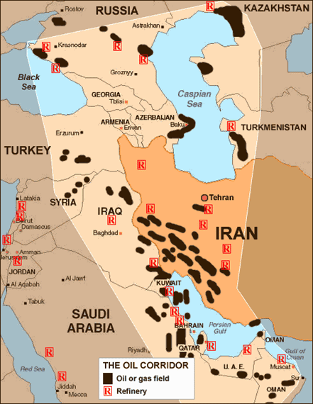
The so-called "Oil Corridor"

Long diplomatic negotiations were initiated but it wasn't until January 1930, that a compromise was achieved. The nationality clause was removed by the Colonial Office, and an oil company, under the umbrella of Standard Oil Company of California (SoCal), was established, termed BAPCO: Bahrain Petroleum Company. It was formed under the conditions that :
  1. that BAPCO would be a British company registered in Canada;
  2. that one of the five directors of BAPCO would be (at all times) a British subject, and his appointment would be made with consultation of the British government.
  3. that BAPCO would always have a Chief Local Representative resident in Bahrain whose channel of communication with the ruler of Bahrain would be through the Political Agent;
  4. that as many employees as possible of BAPCO in Bahrain would be British or Bahraini subjects.
Finally, the Open Door policy was officially sanctioned. Events moved quickly after that and on the 31st of May 1932, oil in commercial quantities was struck in Bahrain. In July 1933, an oil concession deal was struck with the Saudis that would later form the basis of the Arabian American Oil Company (ARAMCO)

John Bull's Face: 1932-1939

In 1938, an article entitled 'Is John Bull's Face Red!' appeared in The American Magazine , it was written in the form of an expose about an 'embarrassing British secret - how Americans beat them to a faraway island of oil [Bahrain]'. A mere article in an ongoing rivalry.

Within a month of the signing of the SoCal deal, the Political Agent in Bahrain expressed his concern that the US government would want to establish a consular office in Bahrain. He was firm in his belief that
It would be most undesirable to have a Consul of the United States of America in Bahrain, as with the Oil interests at his back, he [the would-be American ambassador] would be likely to acquire a powerful position - indeed, he might well tend to supplant the Political Agent!
The BAPCO oil refinery.
The position of the Political Agent in Bahrain was government by the second clause of the 1892 Exclusive Agreement whereby Bahrain undertook not to assent to the residence there of any country or entity but the representative of the British government

As such, he was the only foreign representative and, after the 1919 Order-in-Council, he was empowered to exercise jurisdiction over all foreigners.

Although no population census of Bahrain was taken during the 1930s, it can be assumed that roughly 18% of the population comprised of foreigners. These were Indians, Iranians , Omanis and other Arabs.

There was no Western Community, aside from that serving the British. When BAPCO started operations, the American community started to grow.

In January 1935, there were 24 Americans workers in Bahrain. By 1938, it reached 153 American workers.

World War II and Renewed Tensions:

Once WWII began, the position of the USA began to change, regarding its Gulf policies. Three principal factors governed this change:

The first was the gradual weakening of  Britain's position in the Arab world as a result of the defeats it suffered at the beginning of the war. In 1940, for example, the Mediterranean Sea became closed to British ships; the next year, Germany controlled Yugoslavia and Greece, Rommel's Afrika Korps pushed the British back to El Alamein. In Iraq, the Rashid Ali movement threatened British control over Iraq and its strategic base at Habbaniyya. The possible consequences of the collapse of the British in the Mid-East would have been disastrous to the Americans.

The second factor was an acute financial crisis in Saudi Arabic that set in immediately after the war, due to a massive decrease in Pilgrim traffic and financial mismanagement. It was so severe that in 1940, the King appealed to the British government for money. The US saw itself as not being ready for Saudi Politics but realizing the importance of Saudi oil, sent money to Britain that was to be given to Saudi Arabia.
World War II Scenario. El Alamein is clearly noted.

The third factor was the enter of the US into the war after Pearl Harbour. The Gulf became of great strategic importance for Allied supply lines and air routes. The importance of oil was acknowledged,, particularly in 1943, when the military and naval campaigns in the Far East were growing. By this time, the major US Departments [of War, of Navy, of the Interior, of the State] were actively involved in oil diplomacy.

The old scenario had changed. Roosevelt declared Saudi Arabia to be vital to the defence of America and hence made it eligible for the lend-lease act. For the first time, Britain was perceived as the strong rival for the implementation of the new policy.

Anglo-American rivalry in the Gulf now began in earnest and in two fronts: On the diplomatic level and in the field. It should be noted,however, that both countries were very close allies and relations did not falter. But the British wanted to strengthen their hold on the region, and the Americans wanted to undermine that hold.

Once the tension between the two was recognized, efforts to rationalize the relationship were made. A landmark in the process was the 1944 Anglo-American conversations on the Middle East, held in London. British policy on the Gulf region faced criticism from the Government of India. The reaction from the Viceroy was anger, he was furious at the acknowledgement of American ambitions in the region. He was particularly worried about an American request to build a US consulate in Bahrain, which he saw as unacceptable. Regardless of the criticism, the talks carried on.

In February 1944, an exchange of telegrams between Churchill and Roosevelt illustrated the fears of both sides. Churchill appealed to the US president that there were misgivings in Britain
That the United States has a desire to deprive us of our oil assets in the Middle East on which among other things, the whole supply of the Royal Navy depends on'
Roosevelt explained his side of the problem:
I am disturbed about the rumour that the British wish to horn in on our Saudi Arabian oil reserves.
A compromise was later reached with Churchill stating that :
We are not making Sheep's eyes at your oilfields in Iraq or Iran
The talks opened on the 12th of April 1944, and lasted for two weeks. The discussion covered many countries considered Middle Eastern including: Egypt, Ethiopia, Palestine, Syria, Lebanon, Iraq, Saudi Arabia, Yemen, Oman, Iran and Afghanistan.
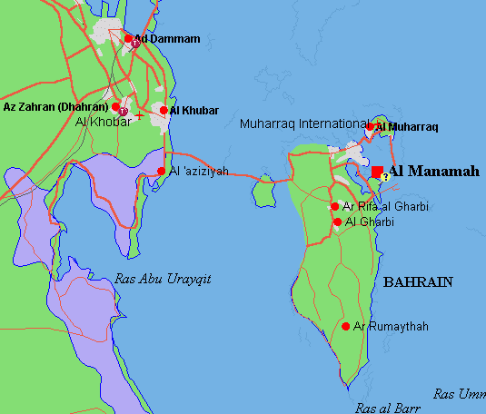
A map of Bahrain and nearby Saudi Arabia

The discussions concerning Bahrain revolved around the wish to establish an American consulate there. Britain refused such an action, citing previous treaty agreements as well as having the fear that this would spark a domino effect on the region. Finally, after much heated negotiations, Britain gave in and a consulate was established in early 1944 and (as predicted) , an American Consulate at Dhahran was opened in September 1944.

[It should be noted that during those times, establishing a consulate was not a simple case, as today, of adding one representative office to another and so on. It was not a routine establishment and it was very complex. It was a sign of influence and strength of a country to establish a  consulate. If one were to be established in Bahrain, it would undermine the British in Bahrain.]

Suspicions of the Americans by the British did not subside. The deployment of 270 soldiers of the US Army Transport Corps to the Consulate, added distrust. America also tried to monopolize the airline system during those times, intending to allow regular flights to and from Bahrain via American civil airlines, this however did not happen.

However, as soon as the war ended, American foreign policy in the region changed once again, this time towards the threat of Communism and of the Soviet Union. Particularly being focused on Russian activity in Iran, particularly after the Tudeh party made statements regarding Bahrain's status. The US now became less interested in Britain's position because of the risk that the Gulf would be an open door to the Russians.

The end of the war also brought with it the realization that Arab oil resources were so large that they could accommodate the interests of both USA and Britain. American policy in the Gulf now had six main thrusts:
  1. To encourage the US missionaries in every way;
  2. To support American commercial interests;
  3. To cooperate with British officials in order to promote US business interests;
  4. to refer to London any outstanding differences between Britain and the USA;
  5. To establish consulates in Muscat and beyond;
  6. To refrain from any measures that would open the region to Russian penetration.
The 3rd and 4th point above indicate the strength of Britain's position. Its main interest in the Gulf had always been strategic, not commercial. The fact that it had been able to withstand Americans resources had been vital to the conduct of the war attests to its ability to maintain the status quo. The political order it had created in the Gulf for over a century remained unchanged despite the dynamics of the changing economic situation. Once again, the Pax Britannica prevailed.

Based on research work done by R.S.Zahlan

Why More Maps Should Be Upside Down

If you've utilised a map at any point in your life, whether it's Google Maps to find out which right turn you just missed on the hig...