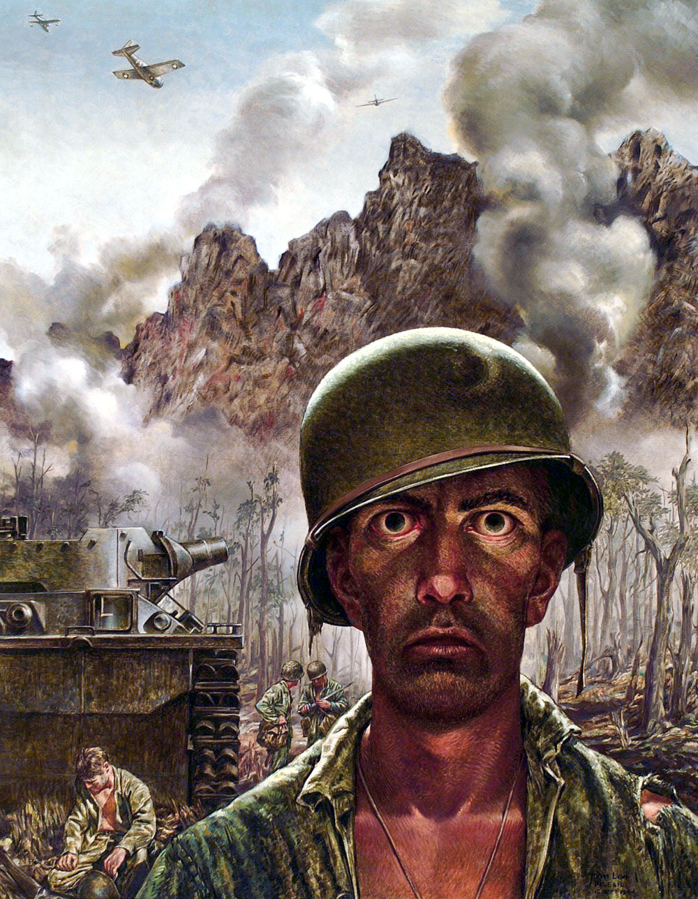
Chances are that, if you read about wars and the effect it has on soldiers, you may have inadvertently seen the "Thousand Yard Stare". The first sign of Post-Traumatic Stress Disorder (PTSD) in many cases, it defined as "a vacant or unfocused gaze into the distance, seen as characteristic of a war-weary or traumatized soldier", by Oxford dictionaries. The origin of the phrase comes from Time magazine's publishing a painting titled "Marines Call It That 2,000 Yard Stare", made by World War II artist and correspondent Tom Lea, although it was not explicitly called that. The painting is a 1944 portrait of a Marine at the Battle of Peleliu in Palau (Pacific theater). About the real-life Marine who was his subject, Lea said:
He left the States 31 months ago. He was wounded in
his first campaign. He has had tropical diseases. He half-sleeps at
night and gouges Japs out of holes all day. Two-thirds of his company
has been killed or wounded. He will return to attack this morning. How
much can a human being endure?
Prolonged exposure to battle causes the thousand yard stare. You can imagine that it was quite common during the Second World War, Vietnam (and practically any war, to be quite honest). It need not be confined simply to war.
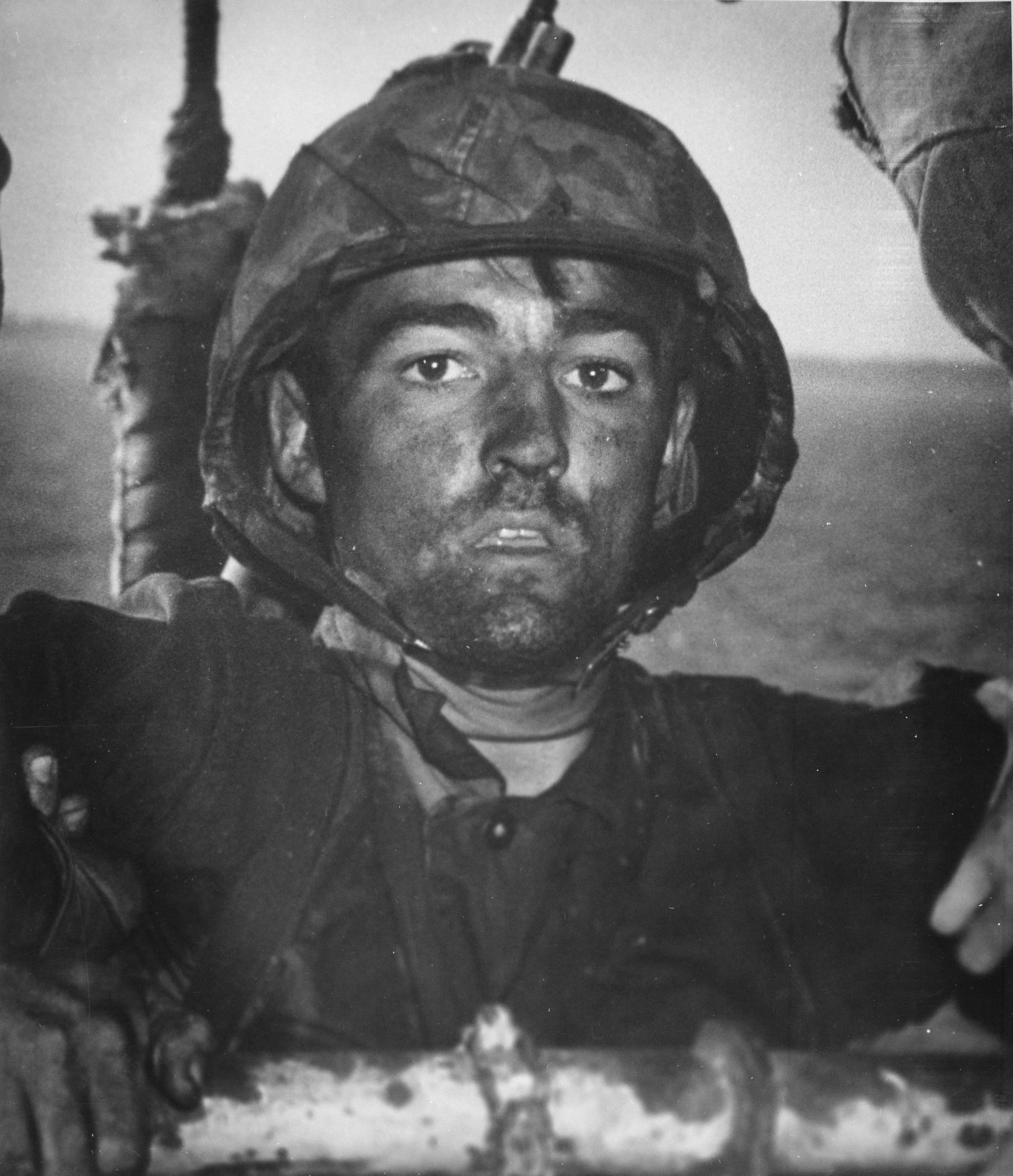
While we're on this topic, it should be clarified that the 1984 photo of Sharbat Gula (popularly coined as the "Afghan Girl"), who obtained international notability for a photo depicting her in a refugee camp in Pakistan after she was orphaned, is generally considered to not portray the stare. But it is still one of the most defining images of the 20th century.
Who was Gamal Abdel Nasser Hussein? A colonel in the Egyptian army in the early 20th century.
Why is he notable? Because he led the 1952 Egyptian Revolution that overthrew the Muhammed Ali (not the boxer!) dynasty and by doing so, drastically changed the Middle Eastern political scene forever.
He was an Arab Nationalist and believed in Pan-Arabism (that is, the unification of Arab states into a single country). During his terms in office, he oversaw the outbreak of the Suez Crisis, the Six-Day war and the "War of Attrition".
He co-founded the Non-Aligned Movement (group of states which are not aligned formally with or against any major power bloc) alongside Yugoslavia's Tito Indonesia's Sukarno, Ghana's Kwame Nkrumah and India's Jawaharlal Nehru.
He was also the president of the short-lived United Arab Republic (a union with Syria that lasted from 1958-1961).
Life, the Revolution and Egyptian Presidency:
Gamar Abdel Nasser was born in Bakos, Alexandria, Egypt, on the 15th of January, 1918. He was educated at the Cairo Military Academy and eventually became an instructor at the institution. During the Second World War Nasser developed republican views. He secretly recruited cadets and young officers into what became known as the Free Officers Movement.
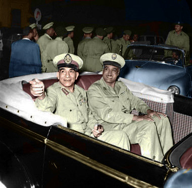
Egypt's first president, Najeeb (l) next to Nasser (dated 1950)
The failed 1948 Palestine campaign reinforced Nasser's view that the government of King Farouk I was inefficient and corrupt. In 1952 General Mohammed Najeeb and Colonel Nasser forced Farouk to abdicate. After the Egyptian Revolution Najeeb became commander-in-chief, prime minister and president of the republic whereas Nasser held the post of Minister of the Interior. In April 1954 Nasser replaced Najeeb as prime minister. Seven months later he also became president of Egypt.
Over the next few months Nasser made it clear he was in favour of liberating Palestine from the Israelis. He also began buying fighter aircraft, bombers and tanks from the Soviet Union and Czechoslovakia. Nasser redistributed land in Egypt and began plans to industrialize the country. He also began the building of the Aswan Dam. Nasser was convinced that this would extend arable lands in Egypt and would help the industrialization process. He also advocated Arab independence and reminded the British government that the agreement allowing to keep soldiers at Suez expired in 1956.
The Suez Crisis
President Dwight Eisenhower became concerned about the close relationship developing between Egypt and the Soviet Union.
In July 1956 Eisenhower cancelled a promised grant of 56 million dollars towards the building of the Aswan Dam. Nasser was furious and on 26th July he announced he intended to nationalize the Suez Canal.
The shareowners, the majority of whom were from Britain and France, were promised compensation. Nasser argued that the revenues from the Suez Canal would help to finance the Aswan Dam. Anthony Eden, the British prime minister, feared that Nasser intended to form an Arab Alliance that would cut off oil supplies to Europe. Secret negotiations took place between Britain, France and Israel and it was agreed to make a joint attack on Egypt.
On 29th October 1956, the Israeli Army invaded Egypt. Two days later British and French bombed Egyptian airfields. British and French troops landed at Port Said at the northern end of the Suez Canal on 5th November. By this time the Israelis had captured the Sinai peninsula.
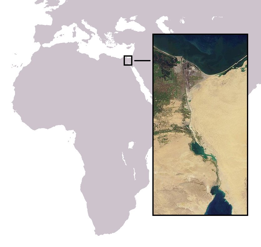
Location of the Suez Canal
President Dwight Eisenhower and his secretary of state, John Foster Dulles, grew increasingly concerned about these developments and at the United Nations the representatives from the United States and the Soviet Union demanded a cease-fire. When it was clear the rest of the world were opposed to the attack on Egypt, and on the 7th November the governments of Britain, France and Israel agreed to withdraw. They were then replaced by UN troops who policed the Egyptian frontier. Nasser now blocked the Suez Canal.
The United Arab Republic:
He also used his new status to urge Arab nations to reduce oil exports to Western Europe. As a result petrol rationing had to be introduced in several countries and two months after the invasion Anthony Eden resigned from office. Nasser was now acknowledged as leader of the Arab world. Egypt now joined with Syria to form the United Arab Republic.
Despite the economic difficulties, what truly produced the demise of the UAR was Nasser's inability to find a suitable political system for the new regime. Given his socialist agenda in Egypt, the Ba'ath should have been his natural ally, but Nasser was hesitant to share power. Though Amer allowed some liberalization of the economy in order to appease Syrian businessmen, his decision to rig the elections of the National Union (the single party which replaced the Ba'ath), with the help of Colonel Abdul Hamid Sarraj (a Syrian army official and Nasser sympathizer), sent Ba'ath leaders into a frenzy. The Ba'ath won only five percent of the seats on the higher committees, while the more traditional conservative parties “won” a significant majority.
Nasser signing the Syria-Egypt union pact alongside Shukri al-Quwatli
Sarraj was appointed head of the National Union in Syria, and by the spring of 1960 had replaced Amer as the chair of the Syrian Executive Council. Under Sarraj Syria was ruled by a brutal security force designed to suppress all opposition to the regime. The immense increases in public sector control were accompanied by a push for centralization. Nasser abolished regional governments in favor of one central authority, which operated from Damascus February through May and Cairo the rest of the year. As a part of this centralization, Sarraj was relocated to Cairo, where he found himself with little real power. On September 15, 1961 Sarraj returned to Syria and resigned his post on September 26. Without any close allies to watch over Syria, Nasser was blind to the growing unrest of the military.
On September 28 a group of officers staged a coup and declared Syria's independence from the UAR. Though the coup leaders were willing to renegotiate a union under terms they felt would put Syria on an equal footing with Egypt, Nasser refused such a compromise. He initially considered sending troops to overthrow the new regime, but chose not to once he was informed that the last of his allies in Syria had been defeated.In speeches that followed the coup, Nasser declared he would never give up his goal of an ultimate Arab union, though he would never again achieve such a tangible victory toward this goa.
In March 1958 Yemen and the United Arab Republic formed the United Arab
States. Nasser also encouraged Arab nationalism and revolution took
place in Iraq.
The Six-Day War:
In early 1967, Soviet premier Alexei Kosygin sent Nasser a warning through Sadat, who was visiting Moscow, that Israel was about to carry out a large-scale assault against Syria. More warnings followed in the next few months, and King Hussein, aware of the intelligence situation, cautioned Nasser in April not to be dragged into a war.
That same month, pressure on him to act by Syria, Saudi Arabia, and the PLO, as well as the general Arab populace, mounted after an aerial battle between Syria and Israel resulted in the downing of six Syrian planes. Convinced that Israel was determined to attack Syria, he asked UN Secretary-General U Thant to withdraw UNEF forces from Sinai.
On 23 May, Egyptian troops moved into Sharm el-Sheikh and Nasser ordered the Straits of Tiran closed to Israeli shipping. On 27 May he stated "Our basic objective will be the destruction of Israel. The Arab people want to fight."After the blockade, he gave a speech to the United Nations General Assembly on 29 May saying, "the issue was not UNEF or closing the Strait of Tiran; the issue is the rights of the Palestinian people."This was the same message delivered a week earlier during a visit to an air base in the Sinai.
The speeches signaled that Nasser believed war was inevitable. King Hussein arrived in Cairo on 30 May and committed Jordan to the United Arab Command—an alliance which also included Egypt and Syria— under the command of Egyptian general Muhammad Sidqi. Amer anticipated an Israeli attack and advocated Egypt launch a preemptive strike. He was backed by former Syrian prime minister Amin al-Hafiz.
Due to assurances, however, from the American administration and the USSR that Israel would not attack, Nasser refused Amer's suggestion, insisting that Egyptian forces in the Sinai should only act defensively. In addition, he questioned the Egyptian military's readiness since the air force lacked pilots, the army reserve lacked training, and Nasser doubted the competence of Amer's hand-picked officers. Simultaneously, Egypt was facing a financial crisis leading him to believe that the country could not afford a war that would last even a few days. Nonetheless, Nasser eventually began changing positions from avoiding war to giving speeches claiming war was inevitable.
On the morning of 5 June, the Israeli Air Force (IAF) struck Egyptian air fields, destroying much of the Egyptian Air Force. Before the day ended, Israeli armor had cut through Egyptian defense lines, capturing the town of el-Arish.
According to Sadat, it was only when they captured el-Qantarah el-Sharqiyya, cutting off the Egyptian garrison at Sharm el-Sheikh, that Nasser became aware of the gravity of the situation.
Conquest of Sinai during 7-8 June
After hearing of the attack, he rushed to the army headquarters to inquire about the military situation. It was here that the simmering conflict between Nasser and Amer came into the open when, according to present officers, they burst into "a non-stop shouting match." Nasser accused Amer of giving unsatisfactory answers to his questions, while Amer asked Nasser for more time to launch a counterattack against the Israelis.
The Supreme Executive Committee, set up by Nasser to oversee the conduct of the war, attributed the repeated Egyptian defeats to the Nasser-Amer rivalry and to Amer's overall incompetence.
Despite the extent of Israel's quick military gains, for the first four days the general population in the Arab states believed the fabrications of Arab radio stations which claimed an Arab victory was near. On 8 June, Nasser appeared on television to inform Egypt's citizens of their country's defeat
Nasser status was undermined by the heavy losses suffered during the Six-Day War. He resigned on 9th June 1967 but following large demonstrations supporting him he reversed this decision. Gamar Abdel Nasser remained in office until dying of a heart attack in 1970. He was replaced by his friend Anwar Sadat.
Death:
On 28 September 1970, at the conclusion of the summit and hours after escorting Emir Sabah III of Kuwait, Nasser suffered a heart attack. He was
immediately transported to his house and was pronounced dead soon after.
His wife Tahia, Heikal and Sadat were present, the last reading the Qur'an at his deathbed.
Nasser with Yasser Arafat and Faisal of KSA, a day prior to his death
Following the announcement of Nasser's death, Egypt and the Arab world were in a state of shock.
It was not publicly known at the time that he had previously suffered
two heart attacks. According to his doctor al-Sawi Habibi, Nasser's
likely cause of death was arteriosclerosis, varicose veins,
and complications from long standing diabetes. Nasser was a heavy
smoker and there was also a history of heart disease in his family; two
of his brothers died in their fifties from the same condition.
His funeral procession through Cairo, on 1 October, was attended by at least five million mourners. The 10-kilometre (6.2 mi) procession to his burial site began at the RCC headquarters with MiG-21
jet fighters flying overhead. His flag-draped coffin was attached to a
gun carriage pulled by six horses and led by a column of cavalrymen.
All Arab heads of state attended; King Hussein of Jordan and PLO leader Yasser Arafat cried openly while Muammar Gaddafi of Libya reportedly fainted twice. Although no major Western dignitaries were present, Soviet Premier Alexei Kosygin showed up.
Anwar Sadat would later succeed him as Egypt's president. The era of Nasserism was over.
Legacy:
Nasser's legacy is much debated today. To his sympathizers, he was a leader who reformed his country and re-established Arab pride both inside and outside of it. They testify that under him, Egyptians enjoyed unprecedented access to housing, education, health services, and nourishment as well as other forms of social welfare.
A young Muammer Qadaffi with Nasser, in 1969
Nasser is credited for severely curtailing British influence in Egypt, elevating it to upper world circles, and reforming the country's economy through agrarian reform, major modernization projects such as Helwan and the Aswan High Dam, and various nationalization schemes.
While Nasser was president, Egypt experienced a cultural boom, particularly in theater, film, literature, and music. Nasser's Egypt dominated the Arab world in these fields, producing singers such as Umm Kulthum and Mohammed Abdel Wahab, literary figures such as Naguib Mahfouz and Tawfiq el-Hakim, and producing over 100 films a year compared to just more than a dozen in recent years.
Time magazine stated that despite his mistakes and shortcoming, Nasser "imparted a sense of personal worth and national pride that they [Egypt and the Arabs] had not known for 400 years. This alone may have been enough to balance his flaws and failures." Until the present day, he serves as an iconic figure throughout the Arab world.
On 5 September the Luftwaffe (Nazi Germany's air-force) switched tactics. Suddenly the weight of enemy attack was concentrated no longer against the bases of the Royal Air Force (of Britain), but against the civilian population of London and other major cities.
Churchill here gives full rein to his outrage and re-avows his determination to secure victory. And so, on 11 September, 1940, Winston delivered one of his iconic inspirational speeches though less famous compared to other speeches.
Right after Ireland, Scotland is probably my second-favourite European country (yes, I have an uncontrollable bias towards Gaelic nations, pity me). Though nowadays, there's much clamour about the upcoming "Vote For Independence" which could see Scotland seceding from the UK for the first time since the Treaty of Union in 1707. While I'm no political commentator (I'd be horrible at that, in fact), it would be simple ignorance to say Scotland couldn't survive on its own. For much of its history, Scotland was first a collection of petty kingdoms and then a unified kingdom under a succession of houses of royalty.. A unique Scottish culture emerged, rivaling that of their English neighbours to the south. In this post, we'll examine the unique culture of Scotland during the Medieval ages. Languages:
Lingustics in 1400 (Blue-Gaelic,Yellow-Scots,Orange-Norse)
Celtic languages were divided into distinct categories:
P-Celtic, which included Welsh, Breton, Cornish and Cumbric.
Q-Celtic, from which come the Goidelic languages: Irish, Manx and Gaelic
Over time, Gaelic became the chief language used by the Scots. It was typically an oral culture, especially in the Kingdom of Alba and much of the Highlands.
In the northern islands of the Shetlands and Orkneys, the norm language was Norse, which was introduced by Scandinavian occupiers who regularly raided and occupied the islands.
In the Scottish burghs (towns concentrated in the south and east of the country), English was the main language. This was due to the region being host to Anglian settlers who brought Old English with them. By 1124, French replaced Gaelic as the official language of the royal courts, evidenced by the presence of French documents.
Later, in the Scottish lowlands, Middle Scots (commonly known as English back then) became became the dominant language of the country. It was derived largely from
Old English, with the addition of elements from Gaelic and French.
Although resembling the language spoken in northern England, it became a
distinct dialect from the late fourteenth century onwards.
It began to be adopted by the ruling elite as they gradually abandoned
French. By the fifteenth century it was the language of government, with
acts of parliament, council records and treasurer's accounts almost all
using it from the reign of James I onwards. As a result, Gaelic, once
dominant north of the Tay, began a steady decline
There were strict rules, some enforced by Acts of Parliament,
governing who could wear what in medieval and Renaissance times.
Fashions changed across the centuries.
The clothes of a medieval bronze caster(from EducationScotland)
The general rule was that
the poorer someone was, the simpler their clothes were: a simple belted
tunic for peasants, shorter for men and longer for women, generally made
of wool or linen.
Men wore ‘braies’ - large baggy underwear -
beneath their tunics. Women wore long slips known as ‘kirtles’. Both men
and women wore ‘hose’ - leggings like long stockings without feet.
In the early medieval period, women's clothing was patterned very much
like men's, but with hems that always reached the ground. In the 11 and
12th centuries, women's clothing began to be more elaborate, with fitted
waists and long, sweeping sleeves.
Sometimes, the elaborate kirtle worn
underneath was deliberately revealed by cutting holes in the outer garment
or gathering it up at the waist.
In Scotland during the 12th century, most women would have dressed more
simply than those in the court of the king of France. For everyday wear,
dresses may have been made of plain, undyed wool cloth, worn over a linen
kirtle.
For more formal occasions, dresses made of red or yellow cloth
would have added some colour. Belts made of wool or leather would also
add some extra decoration
Nobles had access to any fabric they liked, including the exotic silks and velvets brought back by crusaders and merchants, but only royalty were permitted an ermine trim.
The establishment of Christianity brought Latin to Scotland as a
scholarly and written language. Monasteries served as major repositories
of knowledge and education, often running schools and providing a small
educated elite, who were essential to create and read documents in a
largely illiterate society.
Tower of St. Salvator's College, St. Andrews.
Until the fifteenth century, those who wished to attend university had to travel to England or the continent, and just over a 1,000 have been identified as doing so between the twelfth century and 1410. Among these the most important intellectual figure was John Duns Scotus, who studied at Oxford, Cambridge and Paris and probably died at Cologne in 1308, becoming a major influence on late Medieval religious thought. After the outbreak of the Wars of Independence, with occasional exceptions under safe conduct, English universities were closed to Scots and continental universities became more significant
This situation was changed by the establishment of the "ancient universities of Scotland". Four universities were established in the Middle Ages:
University of St Andrews – founded 1413 (incorporating the University of Dundee for most of its history until 1967)
The accessibility of cuisine depended on location and class status. For example, a lord in a castle would have a small army to prepare the food for the household. The cook would lead the
undercooks and the bakers. Larderers would make sure the kitchens were well
stocked. Poulterers would prepare the birds. Bread was made fresh and baked
in huge ovens. Fruit and vegetables were gathered from the castle’s
orchards and gardens. And for ordinary people? Most ordinary Scots ate what we would eat today; They had two meals a day, made from food which they had grown or produced themselves. They ate a lot of food made with oats – a heavy kind of oat bread, porridge and rough, thick oatcakes called bannocks. Stews and thick soups called pottage were also common and sometimes mutton from sheep. Villagers close to the sea had easy access to fish.
Haggis, arguably Scotland's national dish, has its origins from 1430
At different times of the year there would be different types of fruit and vegetables. Many people kept cows and hens for milk and eggs. Honey was the only way of sweetening food. Everyone - even children! - drank a weak kind of home-made beer made from barley because it was difficult to make sure that water was clean.
Food was often strongly seasoned with herbs and spices, including garlic, rosemary, fennel, mint, parsley, cinnamon, peppercorns, root ginger, cloves and nutmeg. Some spices were imported via the Pilgrim routes to the Holy Land after they were brought back by crusaders. Salt was very expensive; such that it became a status symbol for kings and rich nobles. Some exotic medieval dishes included 'meat jelly'. Medieval Scots also ate all sorts of creatures we don’t eat today
including swans, peacocks, seals, lampreys and porpoises. They ate lots
of birds including small wild birds as well as geese and pheasants. Fish
was a regular dish as the church forbade the eating of meat during Lent
and on Wednesdays, Fridays and Saturdays. Herring, pike, salmon and
bream were commonly eaten as well as eels, which were caught in lochs
with wicker eel traps and barbed eel spears.
Some rather old maps of the Arabian peninsula, details under each respective map.
It's bigger when you click it !
Embedded text: This map of the Arabian Peninsula, published in 1720, shows Arabia
Felix, Arabia Deserta, and Arabia Petraea. Other regions included are
Palestine, Mesopotamia, Chaldea, Persia, Aegyptus, and Aethiopia. A
large number of towns are shown. The title cartouche includes nine
vignette coins. The tribal and town names on the map are those used by
Ptolemy. Some are used more than once, with variations. Thus “Indicara,”
“Iacara,” “Ichara,” and “Aphana” all could indicate the same place: the
spot where Alexander the Great intended to build a capital on an island
in the Arabian Gulf, enabling him to control the trade of the region
and extend his empire (a scheme that he was unable to accomplish before
he died).
Archeological research suggests that this place was Failakah
Island in present-day Kuwait, although some historians place it at Abu
Ali Island. The map shows a peninsula near present-day Bahrain. The
islands of “Arathos” and “Thylaso” indicate Muharraq and Bahrain
islands, respectively, which are actually located north of Qatar. On
this map, they are placed on the Persian coast side, probably because
the cartographer confused them with “Hormuz” and “Qishm.” Qatar is
mentioned on the map as “Catara,” but its shape and location are not
accurate. The map is by Christoph Weigel, a German engraver, art dealer,
and publisher.
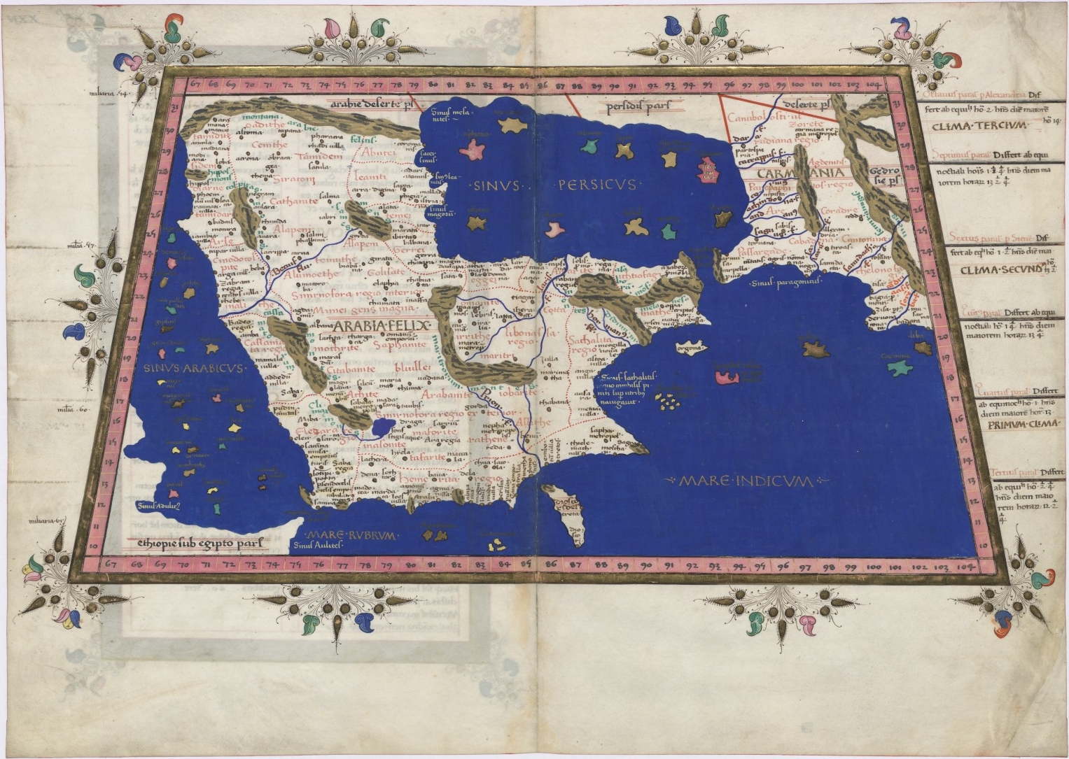
Embedded text:This map from Ptolemy’s Geographia was
published in 1578 and reprinted on many occasions between 1584 and 1704.
It is much more finely engraved than maps in previous Ptolemy editions.
The map mentions several places in present-day Qatar (Abucei, Leaniti,
Themi, Asateni, and Aegei). Names added to this edition of the map
include Mesmites Sinus, Idicar, and a second Idicar, located in
present-day Kuwait. This name is similar to the island of “Ichara” found
near Magorum Sinus. Contemporary research has confirmed that Kharj is
the island known to the ancients as “Icara.” One of the major peninsulas
shown on the map is named “Chersonesi Extrema,” near Catara. Modern
scholarship has identified Chersonesos as Ras Rakn in present-day Qatar.
Ichtyophagorium Sinus is the gulf inhabited by the people identified in
ancient histories as the “Fish Eaters.” Claudius Ptolemaeus, known in
English as Ptolemy, was an ancient mathematician, astronomer,
geographer, and astrologer who was born sometime after 83 A.D., most
likely in a town in the Thebaid called Ptolemais Hermiou in Roman Egypt.
He lived in Egypt and died in Alexandria around the year 168.
Embedded text:This 1616 map is a reprint of a map originally
published in 1598 by Jodocus Hondius (1563-1612), a Flemish
cartographer and engraver who settled in Amsterdam in about 1593 and
established a business that produced globes and the first large maps of
the world. The map covers the territory from west of the Gulf of Suez to
the eastern side of the Arabian Peninsula, and from the mouth of the
Euphrates River to Aden. The only cities indicated on the western coast
of the Persian or Arabian Gulf are Qatar (“Catara”), “Godo,” and
“Catiffa.”
The map shows sandbanks around the coast and rivers at Medina
and Mecca. Few towns and regions are shown, and there is a range of
mountains in the center of the peninsula. Al Qatif is repeated as the
town “Catiffa” and the region “Elcatif.” The peninsula opposite Bahrain
Island, shown unnamed, is marked as where “Catara” is found. The
commonly noted rivers of the Arabian coast are shown as very close
together. The Arabian Gulf is called “Persicus Sinus” (Persian Gulf) and
there is no name given for the Red Sea. The Ayaman area is shown as the
most populated area on the map. The cartographer uses castles to denote
cities and dotted lines to show the division of the Arabian Peninsula
into three parts.
(Click for larger image)
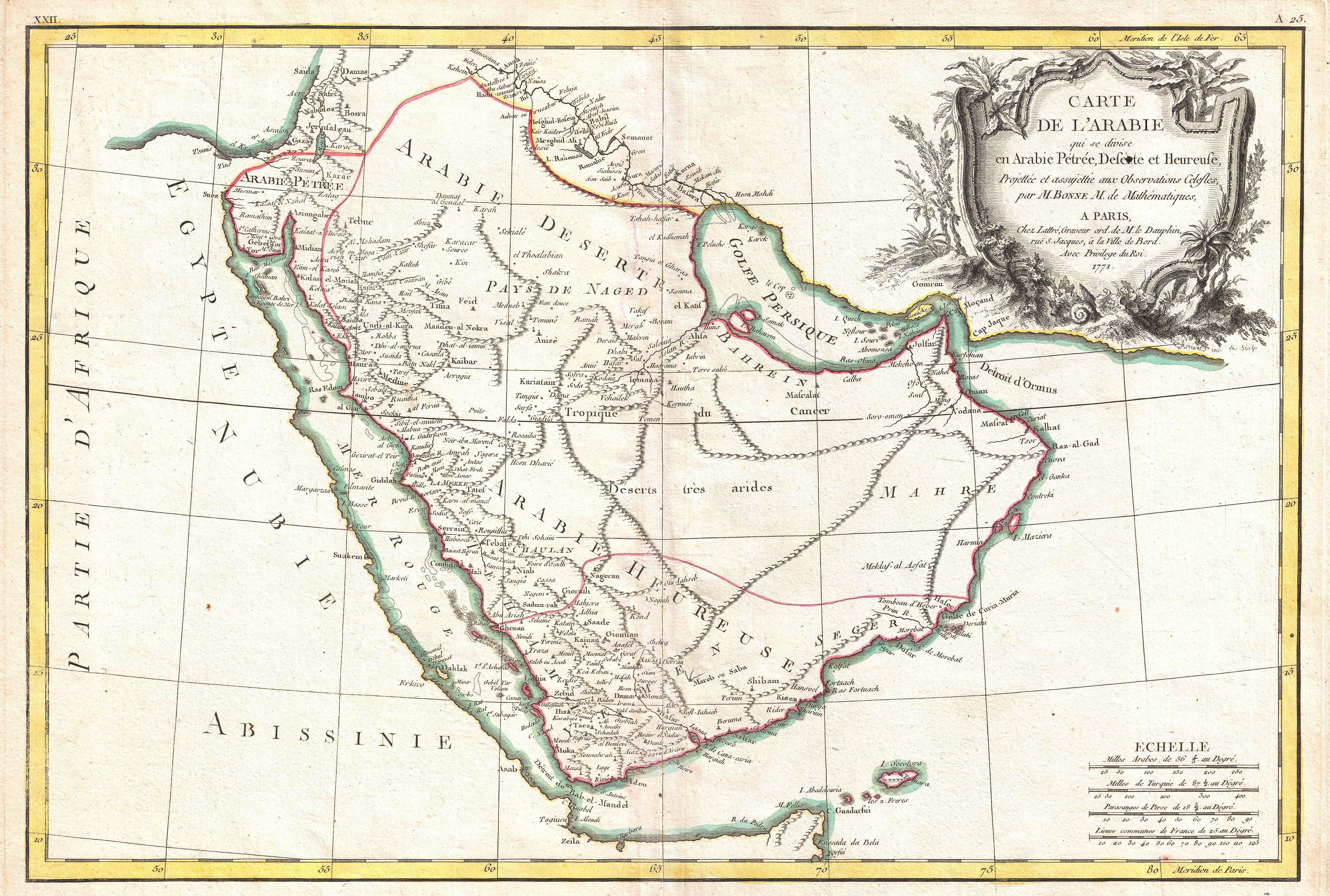
Embedded text:
A beautiful example of Rigobert Bonne's 1771 decorative map of the
Arabian Peninsula. Covers from the Mediterranean to the Indian Ocean and
from the Red Sea to the Persian Gulf. Includes the modern day nations
of Saudi Arabia, Israel, Jordan, Kuwait, Iraq, Yemen, Oman, the United
Arab Emirates, and Bahrain. Names Mt. Sinai, Mecca and Jerusalem as well
as countless other cities and desert oases. Also notes numerous
offshore shoals, reefs, and other dangers in the Red Sea and the Persian
Gulf. There is a large decorative title cartouche in the upper right
hand quadrant. A fine map of the region. Drawn by R. Bonne in 1771 for
issue as plate no. A 25 in Jean Lattre's 1776 issue of the Atlas Moderne
.
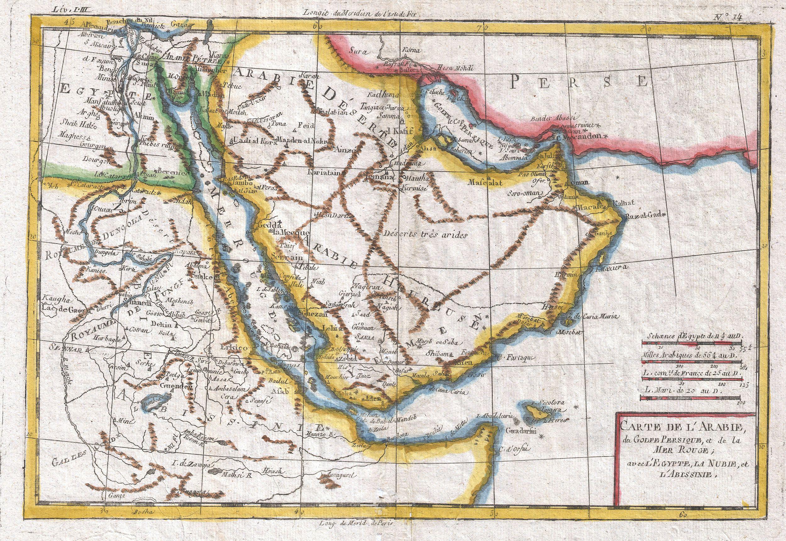
Embedded text:A fine example of Rigobert Bonne and G. Raynal’s 1780 map of the Arabia
and Abyssinia (Ethiopia). Covers from the Nile Delta south as far as
the Horn of Africa and West to Persia, inclusive of the modern day
countries of Ethiopia, Egypt, Saudi Arabia, Yemen, Oman, Kuwait, the and
the United Arab Emirates. Offers surprising detail considering that his
part of the world was largely unknown to Europeans.
Identifies towns,
rivers, some topographical features, ports and political boundaries.
Dangerous reefs and other undersea dangers that historically hindered
trade in the Red Sea and the Persian Gulf are tentatively ghosted in.
Drawn by R. Bonne for G. Raynal’s Atlas de Toutes les Parties Connues du
Globe Terrestre, Dressé pour l'Histoire Philosophique et Politique des
Établissemens et du Commerce des Européens dans les Deux Indes .
(Click for larger image)
Embedded text: A particularly interesting historic map, this
is Karl von Spruner’s 1865 rendering of Arabia, Aethiopia (Ethiopia) and
Egypt (Aegyptus) in antiquity. Centered on the Red Sea or Mare Rubrum ,
this map covers the entirety of the Arabian Peninsula, the Persian
Gulf, and the Nile Valley as far south as Lake Tana (Pseuba), the source
of the Blue Nile. Like most of Spruner’s work this map overlays ancient
political geographies on relatively contemporary physical geographies,
thus identifying the sites of forgotten towns and villages, the
movements of armies, and the disposition of lands in the region. This
particular example includes both ancient Latin and more contemporary
Arabic names (transliterated of course) for many important regions and
sites.
Additionally, two inset maps are offered. In the lower left hand
quadrant a map labeled “Heptanomis et Thebais” focuses on the course of
the Nile from Heptatnomis (near Fayum) south to just past modern day
Aswan, covering in the process many of the ancient Egyptian cities now
submerged under the waters of Lake Nasser. Another inset, in the upper
right quadrant, focuses on the fertile Nile Delta, forming an inverted
triangle between Alexandria, Memphis, and Casluch. As a whole the map
labels important cities, rivers, mountain ranges and other minor
topographical detail. Territories and countries outlined in color. The
whole is rendered in finely engraved detail exhibiting the fine
craftsmanship for which the Perthes firm is known
(Click for larger image)
The Arabian Peninsula by Nicolaus Germanus in 1467
Map of the location of Arab tribes in 600 AD
(Click for larger image)
Title:Arabia Felice Nuova Tavola
Made in Venice
FIRST EDITION 1561
SIZE 18.0 x 24.7 cms
TECHNIQUE Copper engraving
(Click for larger image)
Embedded text: Map of Persia and Arabia from J. H. Colton’s
1855 Atlas of the World. Covers Afghanistan, Iran, Iraq, Jordan, and the
Arabian peninsula ( Saudi Arabia, Yemen, Kuwait, United Arab Emirates,
and Oman). Map is a lithograph from a steel plate engraving. Details
desert trading routes, oases, trading centers, etc. Beautiful hand color


_-_Geographicus_-_PersiaArabia-c-55.jpg)


